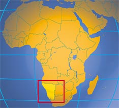
Namibia

Phone: +264-61-2848111
Fax: +264-61-249144
Fax: +264-61-249144
gschneider@mme.gov.na
http://www.mme.gov.na/gsn/
Namibia Diamond Act
Namibia Petroleum Act 1991
Namibia Petroleum Laws Amendment Act 1998
Chamber of Mines
http://www.mme.gov.na/gsn/
Namibia Diamond Act
Namibia Petroleum Act 1991
Namibia Petroleum Laws Amendment Act 1998
Chamber of Mines

Source: CIA Factbook

 Legend

 Legend and ore deposit name
Geology
The geology of Namibia encompasses rocks of Paleo-, Meso- and Neoproterozoic age found mainly in the western half of the country and dominated by metasediments of the Damara Group to the north and older crystalline basement, including the Namaqua Metamorphic Complex, in the south. Paleozoic to Cenozoic sediments occur in the south and north western areas and include deposits of the Karoo Supergroup. Extensive Cenozoic surficial sediments blanket the north and eastern parts of the country.
MINING
Its economy is heavily dependent on the extraction and processing of minerals for export and mining accounted for 12.4% of GDP providing more than 50% of Forex earnings. Namibia is one of the world’s major producers of diamonds 95% of which are of gem quality; it is the sixth largest diamond producer in Africa (2.5% of total output) and diamond mining alone accounted for 5.8% of GDP. Namibia is the fourth largest exporter of non-fuel minerals in Africa, the world's fifth largest producer of uranium and a major producer of lead, zinc, silver, manganese and fluorspar. In 2008 Namibia’s uranium production rose by 51.6% making the country the leading producer in Africa and accounting for 10 per cent of world production. It is the seventh ranked producer of fluorspar accounting for 2.2 per cent of world production. Namibia is Africa’s sole producer of white arsenic, leading producer of zinc (58.8%), third largest for fluorspar (19.7%) and salt (16.3%), fourth for lead (6.4%), fifth for silver (2.3%) and sixth for mined copper (0.9%). Copper and lead production rose by 51.7 per cent and 33.3 per cent respectively in 2008.


- Namibia 250k topographical maps
- Namibia Google Satellite Maps
- Namibia Cities,Towns, Airports, Maps, Images
- Namibia Geology
- Namibia Geological Survey
- Namibia Gravity
- Namibia Image-1
- Namibia Image-2
- Namibia Image-3 Navachab Gold Mine (AngloGold)
- Namibia Image-4 Rössing Uranium Mine (Rio Tinto))
- Namibia Image-5 Skorpion and Rosh Pinah Zinc mines
- Namibia Magnetics
- Namibia Mineral Maps (Namibian Geological Survey)
- Namibia Mineral Resources: Uranium chapter
- Namibia Minerals
- Namibia Radiometrics
- Available geological maps (75)
- Available geophysical maps (1)
Click HERE for an overview
| Year | Production | Unit of Measure | % Change |
|---|---|---|---|
| 2002 | 18012 | Metric tons | NA |
| 2003 | 16175 | Metric tons | -10.20 % |
| 2004 | 11174 | Metric tons | -30.92 % |
| 2005 | 10900 | Metric tons | -2.45 % |
| 2006 | 6262 | Metric tons | -42.55 % |
| 2007 | 8500 | Metric tons | 35.74 % |
| 2008 | 8300 | Metric tons | -2.35 % |

%20kal.png)
- Weatherly International plc operates the Tsumeb West, Tschudi, Otjihase and Matchless mines as well as the Tsumeb custom smelter. The company has a current resource base of 690,000 tonnes of contained copper (JORC) and is targeting 20,000 tonnes of copper on an annualised basis in 2008 from its own mining operations.

NUNW eyeing Weatherly
- by Desie Heita (New Era)
11 June 2010
WINDHOEK – Umbrella union body, the National Union of Namibian Workers, is set for ownership in Weatherly’s copper mining operations, after Mineworkers Union of Namibia abandoned talks less than six months into negotiations.
Weatherly is about to reopen two copper mines, Matchless and Otjihase, and is exploring for an additional copper mine at Tschudi and a zinc/lead mine at Berg Aukas.
National Union of Namibian Workers, through its commercial arm Labour Investment Holdings, is now in discussions with Weatherly International for equity shareholding in all mining assets of Weatherly Namibia.
Chief Executive Officer for Labour Investment Holdings, Cleophas Mutjavikua, confirmed negotiations, saying “these are on-going and are at a very sensitive stage right now.”
Weatherly International dropped a bombshell late last month, when, in a London update to shareholders, it spoke of advanced negotiations with a Namibian black economic empowerment partner.
Surprisingly, the update did not name Nam-mic, Mineworkers Union of Namibia’s commercial arm, who since late 2009 has been in discussions with Weatherly International for partnership in local mining operations.
Seemingly, the discussions between the two started on a bad footing. Nam-mic (Namibian Mineworkers Investment Company) are said to have walked out of discussions.
“We have suspended the negotiations until at a later stage,” Nam-mic’s chief executive Josia Kaitungwa told New Era. Nevertheless, Kaitungwa says they would continue monitoring developments at Weatherly with possibility of resuming discussions at a later stage. “But for now we have suspended the discussions,” emphasised Kaitungwa.
Weatherly hinted that negotiations with new trade union partners would help curb possible industrial unrest in the future.
“The company [is] in negotiations with a black economic empowerment partner which will mitigate future industrial trouble and create greater commitment by local stakeholders in the successes of the project,” said Weatherly International in its London update to shareholders.
Trade unions have been pushing for direct ownership in Namibian mining companies, and repeated the demands when Weatherly Namibia shut down copper mines during the global financial crisis of 2008.
Weatherly International has since bounced back through a series of several asset sales and refocusing of operations.
Weatherly International told shareholders that it “is now back in business at a very opportune time”. At one point the company was knee-deep in debt and gasping for air, going as far as offering to sell half of its ownership to Chinese state-owned company East China Exploration Company. The discussions for the sale were subsequently terminated and the company opted to instead sell the Tsumeb copper smelter to Canadian mining company Dundee Precious Metals for N$44,4 million.
“The company is looking to benefit from the current copper price by reopening two of the mines and accelerating development of a third new copper mine,” says Weatherly.
The plans for reopening of Otjihase and Matchless mines are complete and the company is now working on equity structure and funding. A feasibility study is out on the possibility of mining operations at Tschudi.

Otjihase Copper Mine
Source: http://weatherlyplc.com
- Kombat Copper Inc. holds an 80% interest in five Mining Licenses and five Exclusive Prospecting Licenses ("EPLs") in the Otavi Mountainlands. The mining licenses contain three past-producing mines (Kombat, Gross Otavi, and Harasib) and extensive mining infrastructure including an 800m exploration and production shaft sunk by Murray & Roberts at a cost of $30 Million USD. The shaft has a 90,000 tonne per month hoisting capacity and was first opened in 2006. Among the three past-producing mines is the flagship Kombat Mine, which opened in 1962 and historically produced approximately 8.7 million tonnes of ore grading an average of 3.3% Cu. Other significant minerals present include Silver, Lead, and Zinc. The Company also holds an 80% interest in five Exclusive Prospecting Licenses ("EPL's") covering an area of 1,550 sq.km within the mineral-rich Otavi Mountainlands. The Company has developed a series of priority exploration targets, which it believes have significant potential due to their geological characteristics and/or their proximity to Tsumeb and the Tschudi Copper Project recently permitted and financed by Weatherly PLC.
- Sabre Resources Ltd focus on the exploration and development of the Otavi Mountain Land Base Metals project in northern Namibia. The two licence areas cover more than 800 km2 and contain over 60 known copper, lead, zinc & vanadium occurrences. Sabre's prospect areas range from grassroots geochemical targets through to resource delineation at the Guchab mining centre and a move to feasibility on the zinc-lead deposits on the Pavian and Hoek Trends.
In 2012 Sabre acquired an 80% holding in the Otavi Valley lease area (EPL 3540), which covers 220 km2 and over 40 km of the strike extents of the Kombat Copper Trend. This trend hosts the Gross Otavi and Kombat mines (which are not assets of the Company) as well as the Guchab Mining Centre. Sabre’s exploration has focused on the area to the east of the Kombat mine around the Guchab Mining Centre, a distance of some 10 km. The Company met with immediate success at Guchab and continues to define further exploration targets through the Kombat East area including Schlangental, Schlenters, Nehlen & Rendezvous.
The Guchab Mining Centre (‘GMC’ or ‘Guchab’) lies 10 km to the east of the Kombat copper mine and was discovered in the early 1900s. The mining centre was worked as a series of open pits, box cuts and underground adits targeting near-surface, high-grade weathered copper sulphide & carbonate mineralisation, at more than 10% copper. These ores were later hand-sorted to create an exportable ore grading more than 33% copper. Mining ceased in 1925 following a collapse in the copper price, with only sporadic mining and exploration in the 1950s and 1970s due to ‘spikes’ in the price of copper. Ironically, Guchab actually produced more (and at a higher grade) ore than the Kombat mine in the early 1900s. A concerted exploration effort was made at Kombat from the 1950s onward due largely to ease of access. Kombat sits on the flats at the base of the mountains, whereas Guchab sits on the mountainside, which has left Guchab untouched by modern exploration. Sabre began exploration of the GMC after acquiring the property in June 2012. Initial targeting and evaluation showed that the copper mineralisation at Guchab extended over more than 4 km of strike, with values of up to 1% copper in soil samples and over 10% copper in surface samples. Initial channel sampling across the GMC yielded a number of highly encouraging results, including:
GCTR0002 16 metres @ 10.16% Copper & 64.00 gpt Silver
GCTR0023 25 metres @ 6.70% Copper & 59.00 gpt Silver
Drilling in the Guchab Canyon, which takes in the area from Eastern Adits into the High Valley, commenced in July 2012, with outstanding results. Subsequent exploration shows the GMC to be the eastern extensions of the Kombat Mine Stratigraphy.
The Schlangental prospect is located on the western side of the Guchab Mining Centre (‘GMC’), on the flats of the Schlangental valley. The prospect was discovered by Sabre in the course of exploration of the GMC and is defined by a number of shallow open pits dating back to the early 1900s. The pits had been excavated to a depth of 3-4 metres, with recent channel sampling by Sabre returning results of:
SCCS0001 15 metres @ 4.21% Copper & 28.06 gpt Silver
SCCS0003 42 metres @ 3.58% Copper & 18.34 gpt Silver
A program of shallow percussion drilling has now been completed across the Schlangental valley. The drilling was designed to penetrate below the soil and sand cover across the prospect area and outline the mineralised halo surrounding the open pits, thereby allowing the effective targeting of a program of deeper RC and diamond drilling.
The Eisernhut prospect is located on the top of a mountain, over 1900 metres above sea level, with a commanding view of the Otavi Mountain Land. The prospect was discovered in the course of prospecting and mining through the GMC in the 1900s. The prospect was located by Sabre in late 2012 in the course of mapping of the area. Subsequent detailed mapping and sampling of the prospect discovered a number of old pits and shafts, where high grade ore had been extracted over more than 30 metres of elevation down the mountainside. The mineralisation at Eisernenhut appears to be hosted by a breccia pipe and takes the form of a ‘quartz-malachite-chalcocite stock work’ that is overlain by an iron–rich, silica gossan at surface.
Rodgerberg is located to the east of the Guchab Canyon, on the eastern end of the GMC. Rodgerberg was worked in the 1920s with small parcels of ore, grading up to 36% copper, being extracted from the mine workings. The mine is famous for producing some of the best known examples of the copper mineral dioptase. Sabre’s exploration program at Rodgerberg has included mapping, rock chipping and channel sampling. Better results have included:
RUUG0001 3 metres @ 10.88% Copper & 473 gpt Silver
RUUG0003 13 metres @ 5.32% Copper & 192 gpt Silver
Rodgerberg is currently a ‘second tier target’ for Sabre in the GMC due to difficulty of access. Exploration will continue on the prospect as the work program advances across the Guchab area.
The Kombat East exploration area takes in the area from the Kombat Copper Mine in the west, through to the Rodgerberg mine in the east. This area covers more than 14 kilometres of highly prospective strike, interpreted to be the extensions of the Kombat Mine stratigraphy. Sabre’s focus remains the Guchab Mining Centre, but the Company is presently evaluating the area to the west of the GMC. Aside from the Guchab, Rodgerberg and Schlangental prospect areas, the Kombat East area holds a number of other targets including:
Rendezvous
This geochemical copper target is also reinforced by the presence of old mine workings within the prospect area. Recent surface sampling has confirmed the target area and a program of channel sampling is being planned prior to drill testing later in the year.
Nehlen
The Nehlen target is located immediately to the east of the Kombat mine lease and was listed as a priority target for Goldfields when they held the area in the 1990s. It was not drill tested at that time due to access issues. However, these issues appear to have been overcome, and Sabre hopes to be drilling at Nehlen during the second half of 2013.
Schlenters
Schlenters is located to the northeast of Nehlen and is presently being investigated.
The Lucas Post Trend lies on EPL 3542 (SBR 70%) and covers more than 25 kilometres of strike, immediately to the north of the Hoek Zinc-Lead Trend. The Lucas Post Trend takes in a number of highly prospective copper targets, including Rooikat in the west through to Jagers in the east. These copper targets include a number of historical mining areas, as well as conceptual targets generated by Sabre. The trend hosts some rare styles of mineralisation, including late stage lead-vanadium mineralisation in the near-surface environment, which shows a strong association with earlier, deeper seated, sulphide mineralisation. The central portion of the trend is dominated by the recent Kaskara discovery.
Kaskara was highlighted by conceptual targeting undertaken by Sabre and its consultants, in particular Douglas Haynes. Kaskara is a mineralised lithological & structural target, which appears to be similar to the nearby Tsumeb copper deposit (24.9 Mt @ 5.5% Cu 11.8% Pb & 171 gpt Ag), located less than 40 km to the north. Kaskara is a large mineralised system, including extensive surface mineralisation and significant mineralised intercepts in drilling. The deep IP target at Kaskara remains only partially tested and requires down hole geophysics, together with digital modelling, to help better target the source of the anomaly at depth prior to exploration recommencing on the prospect.
Kaskara was highlighted by conceptual targeting undertaken by Sabre and its consultants, in particular Douglas Haynes. Kaskara is a mineralised lithological & structural target, which appears to be similar to the nearby Tsumeb copper deposit (24.9 Mt @ 5.5% Cu 11.8% Pb & 171 gpt Ag), located less than 40 km to the north. Kaskara is a large mineralised system, including extensive surface mineralisation and significant mineralised intercepts in drilling. The deep IP target at Kaskara remains only partially tested and requires down hole geophysics, together with digital modelling, to help better target the source of the anomaly at depth prior to exploration recommencing on the prospect.
The Pavian & Hoek Zinc-Lead Trends are found on Sabre's EPL 3542 (SBR 70%). These two trends each cover more than 25 kilometres of strike and host significant zinc-lead resources. The resources at Border (16.2 Mt @ 2.1% Zn+Pb) on the Pavian Trend, and Driehoek (3-6 Mt @ 2-5% Zn+Pb) on the Hoek Trend, were Sabre's primary driver for the acquisition of the Otavi Mountain Land project in 2007.
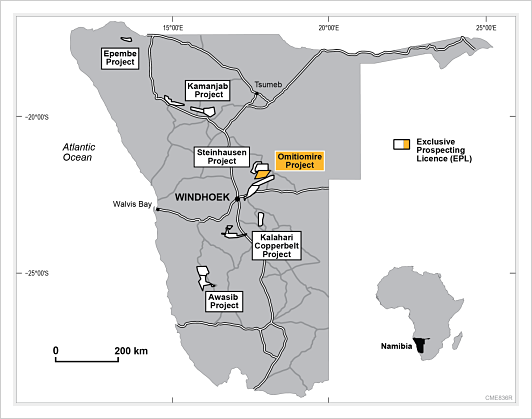
- Omitiomire is an unusual large low grade copper deposit in central Namibia. Craton Mining and Exploration (Pty) Ltd, a subsidiary of Sydney-based International Base Metals Limited, has drilled 250 holes to define a resource of 98 million tonnes at 0.51% Cu (500,000 tonnes contained copper) over an area of 2200 x 700 metres. Banded mafic rocks, which host the disseminated chalcocite, consist mainly of quartz, plagioclase, biotite and amphibole with minor chlorite, epidote, sphene, K-feldspar and magnetite. Low levels of gold and platinoids are associated with copper. Metallurgical testwork has shown excellent recoveries. Known extensions indicate that a target of + 1 million tonnes contained copper is achievable. Extensive geochemical anomalies suggest that Omitiomire could be part of a significant new copper district. In seeking analogies, there are similarities with the Lumwana copper-cobalt deposits (700 Mt at 0.7% Cu) in northwestern Zambia and perhaps with copper deposits in the Carajas district of northern Brazil. The Company has commenced a Definitive Feasibility Study (‘DFS’) on the Phase 1 oxide copper project. Johannesburg-based Basil Read Matomo has been awarded a contract to manage the DFS, which is planned for completion by September 2013. The Steinhausen Project, surrounding the Omitiomire Project, contains numerous known copper occurrences which have not been explored since the 1970s, as well as other targets to be tested. The Kalahari Copperbelt stretches discontinuously for 800 km from central Namibia to northern Botswana. The belt is of similar age to, and has similar styles of copper mineralisation as, the Central African Copperbelt of Zambia and the Congo (DRC). Craton holds three EPLs, totalling more than 1,700 km2 in the area. For the past several years, Craton has been focussing its exploration on the potential for copper in the lower part of the Damara Sequence. This was thought to be geologically analogous to the situation in the Zambian Copperbelt. Based on this exploration concept, Craton applied for, and was granted, EPLs 3372, 4296, 4297 and 4431, covering a large strike length (over 100 km) where lower Damara strata onlap onto the Kamanjab Inlier basement high. The Company has identified a small copper deposit at Tzamin in EPL 4431. A comprehensive exploration programme in EPL 3372 Kopermyn (now relinquished), involving geological mapping, geochemical and geophysical surveys, and drilling on targets, showed widespread but low grade copper mineralisation in the target rock units. The work gave no indication of the likely presence of a significant copper deposit. Accordingly, the potential for discovery within the lower Damara Sequence has been down-graded substantially.
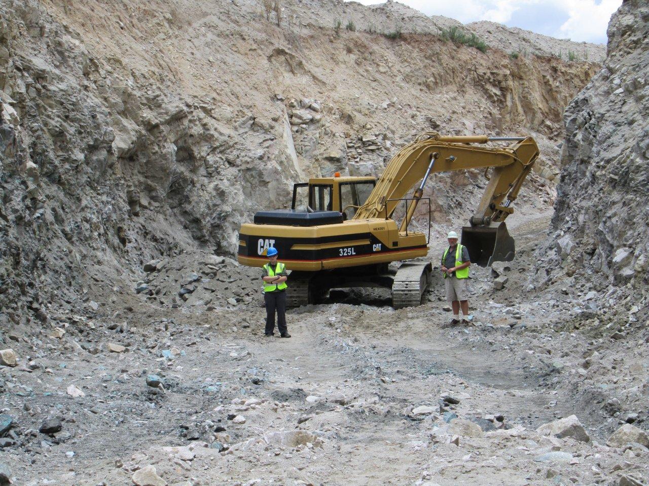
The bulk samoling pit at Omitiomire
Source: http://www.interbasemetals.com
- Helio Resource Corporation (Canadian, HELOF.PK, HRC.V) holds a number of exclusive prospecting licenses in northern Namibia over known copper-gold occurrences.
Diamond

History
The find that constituted the discovery of diamonds in the Namib Desert was made in April 1908 at a railway siding near Lüderitz. Zacharias Lewala, one of the men employed to keep the railway track free of drift sand and who had previously worked on the Kimberley diamond fields, picked up a stone and recognised it as a diamond. This discovery led to the August 1908 proclamation of the Sperrgebiet, or forbidden territory, a region that today stretches some 360 kilometres along the coast and reaches 100 kilometres inland. According to the terms of the proclamation, nine companies obtained rights to prospect and mine in the Sperrgebiet. After the outbreak of World War One, South Africa invaded the German protectorate of South West Africa (SWA, now Namibia) and assumed administration of the country. Five years later, Sir Ernest Oppenheimer, acting on behalf of Anglo American Corporation, acquired control of the nine mining companies and in February 1920, amalgamated them into the Consolidated Diamond Mines of South West Africa (CDM). In 1923, the SWA Administration and CDM concluded the Halbscheid Agreement, which accorded CDM mining rights in the Sperrgebiet. Through negotiation, CDM's rights in the restricted area were extended to 31 December 2010. In 1931, De Beers Consolidated Mines bought Anglo American's interest in CDM, later making CDM a wholly owned subsidiary in 1975. In spite of previous exploration attempts, diamonds were only discovered on the north bank of the Orange River in 1928. This led to the establishment of Oranjemund in 1936 and the eventual transfer of the company's headquarters from Lüderitz to Oranjemund in 1943. Based in Switzerland, De Beers Centenary AG was formed in 1990 to head a group of companies that incorporated the international interests previously held by De Beers Consolidated Mines Limited. CDM was one of those companies. In 1994, in terms of an accord concluded with the Namibian government, CDM was reconstituted as Namdeb Diamond Corporation (Pty) Limited, an equal partnership between the government and De Beers Centenary AG.
Diamonds were first discovered on the south bank of the lower Orange River by Dr Ernst Reuning in 1957. Following this discovery, prospecting on the Northern Bank started in 1968. Exploration and sampling for Auchas deposit started in 1986. Auchas mine started production in June 1990 and closed in June 2000. Daberas mine started in October 1999 and it was officially inaugurated on the 30 May 2002. As of 2006, Daberas has a 4 years life of mine left. A pre-feasibility study for the Sendelingsdrif area which was completed in 2004 indicated a potential seven year life of mine. A full feasibility study will be undertaken during the first quarter of 2008. (Source: De Beers)
"Celebrating a Century of Pretty Stones" (Source: New Era)
Three major, long-standing transport pathways - which can be likened to conveyor belt systems - have been instrumental in moving diamondiferous sediment from source localities to sink areas: Fluvial conveyor - principally the Orange-Vaal River drainage system, marine conveyor - in this passive margin setting, the Atlantic wave regime is vigorous with a strong north-bound longshore drift driven by a prevailing southerly wind regime, desert conveyor - the arid climate and prevailing southerly wind regime of the Namib Desert facilitates onshore movement of marine-derived sediment back into a land-based sink. En route, and over geological time, diamonds have been concentrated in a number of different placer types that span terrestrial and marine settings. Following the discovery of diamonds to the north of the Orange River mouth in 1928, an ore body was delineated, which is today known as Mining Area 1. The area consists of raised beaches over a distance of approximately 100km north of Oranjemund, to Chameis Bay along the present day coastline. Bordered in the east by a geological boundary known as the "east cliff", this strip of land is nearly 3km wide in the south, narrowing to about 200m in the north. A typical beach consists of a layer of gravel between ancient high and low water marks, a storm beach or ridge and a marine platform or shelf containing gravel. Diamonds may be found in any portion, but occur most abundantly in the beach and shelf gravel found upon and within the deeply gullied and highly contorted bedrock. Ore deposits are about 2m thick, while the overburden thickness can reach a thickness of 20m in places. (Source: De Beers)
- Namdeb Diamond Corporation (Pty) (De Beers 50%, Government 50%) is currently producing less diamonds from onshore operations than that being produced by De Beers Marine Namibia (De Beers 70%, Nambeb 30%), which produced a total of 922 000 carats in 2005. Since 1908 more than 100 million carats have been produced from the dwindling and, in many instances, depleted reserves (see video)
- Diamond Fields International Ltd (Canadian), through its subsidiary Diamond Fields Namibia, owns a 100% interest in a mining license offshore (71,600 hectares). It has recovered more than 110,000 carats to date.
- Trans Hex has three shallow marine licenses in the Cape Fria area, four in the Toscanini (both north of Walvis Bay) and two south of Hollandsbird Island (north of Luderitz Bay). The company also has a resource of 30 million cubic metres of diamondiferous gravel at the Northbank project located in block 9, on the Orange River.
- Afri-Can Marine Minerals Corporation (Canadian) is exploring an offshore block covering an area of 994 sq. km, 105 km. north of Luderitz.
- Rusina Mining NL (Australian) investigated and abandoned the onshore area from Cape Fria northwards to the Angola border.
- Reefton Mining NL (Magna Mining) is exploring a 220 km onshore stretch from Möwe Bay to Cape Fria.
- Mount Burgess Mining NL has been exploring the Tsumkwe project, which is located 450 km northeast of Windhoek on the Botswana border and covers some 8,000 square kilometres held under 9 Exclusive Prospecting Licences seven of which are in joint venture with Kimberlite Resources (Pty) Ltd. Motivation for the project includes that it is located on the southern margin of the Congo-Angolan Craton, just south of Limpopo-Botswana dyke swarm, at a distance similar to the Orapa-Letlhakane kimberlite province in neighbouring Botswana, over a long-lived, stable basement high with Pre-Damaran basement dated >2,000 my, just south of the Sikereti kimberlites and south west of the Nxau-Nxau kimberlite field in Botswana; and in an area where 8 macrodiamonds, together with significant numbers of G9 and G10 garnets have been discovered, delineating discrete anomalies which the company believes have been sourced locally.
- 's Kavango Project (24 Exclusive Prospecting Licenses encompassing 2,09 million hectares) in northeast Namibia, using high resolution magnetics, has resulted in the discovery of eight kimberlites. With the exception of two (which have less than 10 m of cover), the kimberlites are covered by approximately 50 m of overburden sediments of the Kalahari formation. Gravity profiles over the confirmed kimberlites suggest that these bodies range from 300 to 500 m in diameter.
- Bonaparte Diamond Mines NL Namib Project:The Namib project is located offshore in the vicinity of Hollamsbird Island, some 250km north of the port of Luderitz on the coast of the Republic of Namibia. Active marine diamond mining operations occur off Luderitz and extend some 100 km further north of Hottentot Bay. The Namib Project comprises Exclusive Prospecting Licence (EPL) EPL3241 (Tsauchab Licence), and EPL3323 (Meob Licence) which are not contiguous but lie in close proximity. More recently the project area has been expanded by the inclusion of an EPL application, EPL 3533 (Tsauchab East Licence) which lies adjacent and inshore of the Tsauchab Licence. These tenements are held in Joint Venture with a Namibian Company, Tungeni Investments cc and represent “grassroots” projects off the Namibian coast.The Tsauchab and Tsauchab East leases lie within the submerged trajectory of the Tsauchab River palaeo channel and also within a south facing coastal embayment. Studies have shown that such features present favourable environments for diamond entrapment and improvement of diamond distribution. On a regional basis, there is evidence of alluvial diamond occurrence along the coastline east of the Meob and Tsauchab leases and reconnaissance seabed sampling over nearby leases by other explorers has identified marine diamond occurrences both to the north and south of the Tsauchab Lease.In the vicinity of the Tsauchab Lease, 5.09 carats have been recovered to the north of the area in 2002 and 15.69 carats have been recovered to the south of the area in 2003 where the largest stone recovered was 0.49carats.Luderitz Project:The Luderitz Project incorporates two Joint Operations Agreements (JOA) between Bonaparte's 100% owned Namibian subsidiary, Bonaparte Diamond Mines (Namibia) (Pty) Ltd (BDN) and Diamond Fields (Namibia) (Pty) Ltd (DFN), a 100% owned subsidiary of Diamond Fields International Ltd. The EPL1607b JOA gives Bonaparte exclusive rights to use the Bonaparte Seabed Sampler (BoSS) to explore for diamonds in Exclusive Prospecting Licence area EPL1607b for an initial period of 3 years in return for 50% interest in mining of resources identified by Bonaparte. The project area covers approximately 140 km2 and is located 55 km north northeast of Luderitz, in close proximity of mining licence areas held by Namibia's three leading marine diamond producers, Namdeb, Samicor and Diamond Fields. Previous exploration work conducted in the tenement by Diamond Fields during the late 1990's includes a complete geophysical survey from which a number of prospective targets have been identified as well as a limited amount of seabed sampling which confirmed the presence of diamonds in the property.The ML111 JOA allows Bonaparte to use the BoSS to carry out a program of resource development sampling in DFN's Mining Licence area ML111 in terms of this agreement. Bonaparte will have exclusive access for 6 months to two designated resource development areas (Diaz Prospect 1 and Diaz Prospect 2) covering a total area of approximately 1,600,000m2 in ML111. Bonaparte will carry out seabed sampling to define areas of Indicated Resource (in compliance with JORC guidelines) in which Bonaparte will then retain a 30% interest in any subsequent mining thereof by DFN.Bogenfels Project:The Bogenfels project lies approximately 100km north of the Orange River and comprises an area covering approximately 2,700 km2 off the coast of southern Namibia situated adjacent to the current producing marine mining licence areas held by Namdeb (De Beers/Namibian Government partnership). It comprises three licences; EPL3407, EPL3403 and EPL3404. The agreements are subject to approval by the Minister of Mines and Energy, Namibia. The Exclusive Prospecting Licence for EPL3407 (Mirror Mountain) was granted in November 2005 and applications for EPL's 3403 and 3404 are pending approval by the Namibian authorities. The project is held in Joint Venture with two Namibian companies, BV Investments cc and Mirror Mountain Mining cc for exploration and development of highly prospective marine diamonds, where Bonaparte retains an 80% interest.Boegoe Hills Project:The Boegoe Hills project comprises EPL3104 and covers an area of approximately 280 km2 which lies adjacent to the onshore mining licence area held by Namdeb, approximately 100km north of the mining settlement town of Oranjemund. The area is considered prospective for alluvial diamonds and lies approx 18 km to the east of Chamais Bay, where commercial diamond production has been carried periodically since the mid 1960's. The project is a JV between Bonaparte and Nassed Enterprises (Pty) Ltd, a Namibian Company, where Bonaparte can earn an interest of 75%. A geomorphological assessment of the data and a geological model for the evolution of the area shows several possible ancient river channel deposits (palaeochannels) as well as a possible ancient shoreline. These features present prospective targets for follow-up.

- Dahava Resources announced in January, 2008, that it had started limited production activities at its Lower Orange river property in Namibia. The company has obtained the right to prospect and mine on Block 4 of EPL 2610. Previous prospecting of the gravels indicated a grade of 1.3 to 1.78 carats per hundred tonnes
Gold in Namibia
Gold Home
Click HERE for an overview
| Year | Production | Unit of Measure | % Change |
|---|---|---|---|
| 2002 | 2815 | Kilograms | NA |
| 2003 | 2508 | Kilograms | -10.91 % |
| 2004 | 2205 | Kilograms | -12.08 % |
| 2005 | 2703 | Kilograms | 22.59 % |
| 2006 | 2790 | Kilograms | 3.22 % |
| 2007 | 2496 | Kilograms | -10.54 % |
| 2008 | 2126 | Kilograms | -14.82 % |
| 2009 | 2022 | Kilograms | -4.89 % |
Source:USGS

The Navachab deposit is hosted by Damaran greenschist-amphibolite facies, calc-silicates, marbles and volcano-clastics. The rocks have been intruded by granites, pegmatites and (quartz porphyry dykes) aplite and have also been deformed into a series of alternating dome and basin structures. The mineralised zone forms a sheet-like body which plunges at an angle of approximately 20° to
the north-west. The mineralisation is predominantly hosted in a sheeted vein set (±60%) and a replacement skarn body (±40%). The gold is very fine-grained and associated with pyrrhotite, and minor trace amounts of pyrite, chalcopyrite, maldonite and bismuthinite. Approximately 80% of the gold is free milling.

- AngloGold Ashanti (NYSE:AU; JSE:ANG) operates the open-pit Navachab mine which produced 81 000 oz of gold in 2005 from ore grading 2,05 g/t Au. Proved and probable ore reserves amounted to 10,1 million t at a grade of 1,67 g/t Au or 16,9 t of gold.
- TEAL Exploration & Mining Incorporated (Canadian, TSX:TL; JSE:TEL) is exploring the the Otjikoto deposit (see B2 Gold below) which has an inferred resource of 25,581 million t at a grade of 1,06 g/t Au or 873 000 oz of gold. In 2007, Teal Exploration & Mining agreed to sell an initial 10% of Avdale Namibia, the subsidiary of Teal holding its Otjikoto gold project, to Nambia’s EVI Mining, which has an option to buy a further 5% once a definitive feasibility study has been completed on the project. EVI will pay $5.5 million, for the intitial 10%, all of which will be used to advance the ongoing exploration drilling program and to upgrade and expand the inferred mineral resource at Otjikoto, which is estimated at 1,76 million ounces of gold, to higher confidence levels. Teal announced in November, 2007, that an independent person had supported the conversion of 460 000 oz of gold at its Namibian Otjikoto project into the indicated mineral resource category. The indicated resources were at a grade of 1,21 g/t. Total contained gold increased from 1,76-million oz to 1,78-million oz.
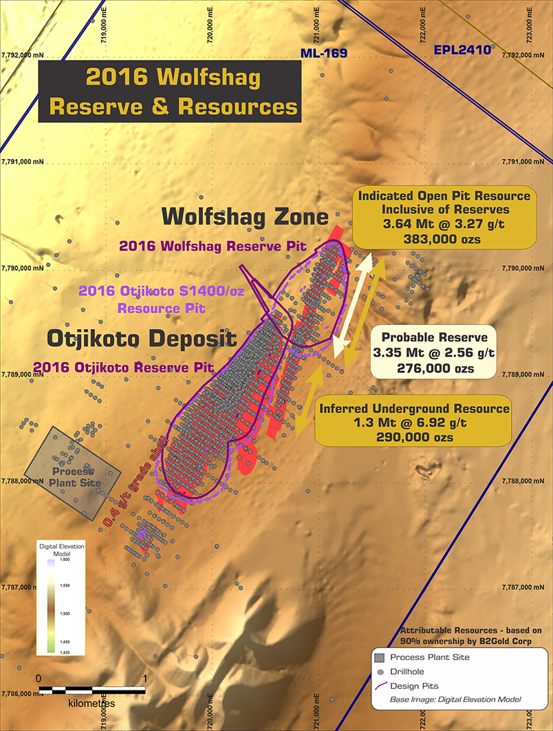
- B2Gold Corporation is a Vancouver based gold producer with three operating mines (two in Nicaragua and one in the Philippines) and a strong portfolio of development and exploration assets in Nicaragua, Colombia, Namibia and Uruguay. B2Gold is projecting gold production in 2013 of 360,000 – 380,000 ounces and approximately 400,000 ounces in 2014 from La Libertad, Limon and Masbate Mines. With the first full year of gold production from the Otjikoto project in Namibia scheduled for 2015, and increased production projected from La Libertad Mine, the Company is projecting 2015 gold production of approximately 540,000 ounces, based on current assumptions. Finally, with the successful completion of the Gramalote project (B2Gold 49% / AngloGold Ashanti Limited 51%) in Colombia, gold production could increase to approximately 750,000 ounces in 2017. Late in 2011, the Company completed the acquisition of a 92% interest in the Otjikoto project in Namibia, by completing a business combination with Auryx Gold whereby B2Gold acquired all of their shares in exchange for B2Gold shares. The Otjikoto gold project is located 300 km north of Namibia’s capital city of Windhoek. Construction commenced in the first quarter at the Otjikoto gold project.and is scheduled for completion in the fourth quarter of 2014 when mill production is expected to begin and the first gold production from the Otjikoto gold project is scheduled. The current mine plan is based on probable mineral reserves of 29.4 million tonnes at a grade of 1.42 g/t gold containing 1.341 million ounces of gold at a stripping ratio of 5.59:1 to be mined over an initial 12 year period. Based on the previously released Feasibility Study by the Company, the current average annual production for the first five years is estimated to be approximately 141,000 ounces of gold per year at an average operating cash cost of $524 per ounce and for the life of mine approximately 112,000 ounces of gold per year at an average operating cash cost of $689 per ounce. The Otjikoto gold project has excellent exploration potential. Subsequent to quarter end the Company announced additional positive drilling results on the new high grade Wolfshag zone near the current planned Otjikoto open pit. Of note, step-out diamond drill hole number WH12-345 returned 35.70 metres grading 4.82 g/t gold, including 15.30 metres grading 7.93 g/t gold, from the recently discovered Wolfshag zone. These positive drill results from the Wolfshag zone indicate the potential to outline additional resources that could lead to the expansion of production at the Otjikoto gold project. Three diamond drill rigs are currently active on the property, focused on the exploration and definition of the Wolfshag zone and parallel structures. An initial inferred resource estimate for the zone is expected by the fourth quarter of 2013. The Otjikoto exploration budget for 2013 is $8.0 million.
- In January 2014 the company announced that construction of the open pit Otjikoto Mine in Namibia remains on time and on budget. Construction is expected to be completed and production is scheduled to commence in the fourth quarter of 2014. In the first five years of its twelve year mine life, the Otjikoto Mine is expected to produce approximately 141,000 ounces of gold per year at an average cash operating cost of $524 per ounce. Pre-development cost estimates of $244 million and deferred stripping estimates of $33 million remain in line with original pre-feasibility study estimates. In addition to these costs, the Company had planned to lease finance mobile mining equipment and power plant costs in the amount of $60 million. However, as a result of Namibian regulations governing the securitization of certain assets, the Compa ny now plans to lease only the mobile mining fleet for a total of $41 million. The balance of the power plant costs has been funded from the Company’s existing cash flows and credit facilities. Leasing arrangements for the mining fleet were concluded in the fourth quarter of 2013 and are expected to be fully drawn and utilized by the end of 2014/early 2015 On November 5, 2013, the Company announced additional positive drilling results from the exploration program at the Otjikoto project. These drill results from the Wolfshag zone, adjacent to the planned Otjikoto pit, further indicate the potential to outline a higher grade resource that could lead to additional future expansion of production and an increase in the mine life. The Company plans to release the initial inferred resource estimate for the Wolfshag zone shortly. The Otjikoto 2014 exploration budget is $8 million. The program will focus on infill drilling the Wolfshag zone and further testing the potential to the south which remains open. Based on the positive drill results from the Wolfshag zone to date, the Company plans to expand the Otjikoto Mine in 2015, increasing ore throughput from 2.5 million tonnes per year to 3 million tonnes. The increased throughput will be achieved through the installation of a pebble crusher, additional leach tanks and mining equipment at a total cost of approximately $15 million. Once the expansion is completed at the end of 2015, annual gold production from the main Otjikoto pit would increase to approximately 170,000 ounces
The total exploration budget for Namibia in 2017 is $5.1 million mainly
for 5,000 metres of diamond drilling on the Otjikoto licence area, and
12,000 metres of diamond drilling and 5,000 metres of RAB drilling on
the Ondundu joint venture project. Drilling at Ondundu in 2016 has
defined a distinct North South zone of mineralization with holes
containing up to 3.10 g/t gold over 68.4 metres drilled in hole
ON-16-092 and 2.58 g/t over 52.1 metres (true width approximately 50% of
drilled width) drilled in hole ON-16-96. An additional 5,000 metres of
diamond and RC drilling are committed to new targets in and around the
Otjikoto area.
- Helio Resource Corporation's Damara Gold Project consists of 3 licenses in Central Namibia, located between 20-100km to the east and northeast of, and in the same geological terrain as AngloGold Ashanti's Navachab mine and approximately 150km southwest of B2Gold's Otjikoto mine. Results from the Gold Kop target returned 50m @ 2.1g/t Au, 0.8% Cu and 14g/t Ag, incl. 7m @ 9.0g/t Au, 4.4% Cu, 73g/t Ag. Other highlights include 12m @ 6.8g/t Au, 14m @ 3.1g/t Au, 7m @ 3.6g/t Au, 4m @ 11.6g/t Au, 5m @ 6.0g/t Au, 6m @ 5.3g/t Au, and 1m@ 32.8g/t Au. Almost 10,000m of drilling on 100m-200m spaced lines confirms potential to locate a sizeable gold target at Gold Kop.
- Etruscan Resources Inc has licences covering a total of 8,970 km2 that were granted between November 2005 and June 2006, and will target the Kamanjab Project where field crews encountered a range of mineralized occurrences of gold and base metals and identified several zones of alteration that may be associated with IOCG type mineralization and the Witvlei Project where a number of historic copper occurrences are known.
- Teck Cominco Ltd (Canadian, NYSE:TCK; TSX:TCK-A) holds several exclusive prospecting licences in the central and northern parts of Namibia ans is involved in early stage exploration.
- Aflease Gold Ltd has a 100% interest in Etendeka Prospecting and Mining Company, a Namibian-based exploration company.
- Solvay SA operates the Okorosu Mine, an open pit fluorite mine located north of Otjiwarongo. It is part of an alkaline igneous-carbonatite ring dike complex where fluorite has replaced pegmatitic carbonatite. The Early-Cretaceous alkaline rocks/sövite complex intruded Late Precambrian Damara series (quartzites, marbles and biotite schists). The metasedimentary rocks have been fenitized in the vicinity of the intrusion. Fluorite also replaces host-rocks (marbles and biotite schists). REE-bearing minerals occur in beforsitic carbonatite dikes and carbonate-fluorite-bearing metasomatites. Their HREE content is significant.
Graphite


Namibia Rare Earths files maiden Lofdal resource, confirms HREE
Namibia Rare Earths Inc had filed a maiden resource for its Lofdal rare earths elements project, confirming the presence of high levels of heavy rare-earth enrichment (HREE) in certain areas of the project. The National Instrument 43-101-compliant resource estimate, covering Area 4 of the project located in the north-west of Namibia, pointed to “exceptional” levels of HREE of between 75% and 93% HREE, depending on the cut-off grade, with corresponding total rare earth oxide grades (TREO) ranging from 0.27% to 1.26%. What distinguishes the project from many other juniors that have entered the market in response to China’s reduction of exports over the past four years – the country produces over 95% of the world’s rareearth’s supply – is its concentration of what are called heavy rare earths. “Given current rare-earth prices, over 90% of the value in this deposit lies in the four critical heavy rare


"Namibia's red hot uranium winners"


There are two types of graphite occurrences in Namibia. One type is found in altered granite of the Namaqualand Metamorphic Complex, and has been mined, and the other occurs in schists and marbles of the Swakop Group, Damara Sequence.
The Aukam Graphite Mine
NextGraphite, Inc. is an exploration development stage company targeting
the Aukam Graphite Project. Aukam contains a special form of graphite
known as “lump” or vein graphite. The Company anticipates revenue
from its existing inventory of unprocessed graphite to commence in
the third quarter of 2016, based on a Letter of Intent to initially
purchase 5,000 tonnes of graphite. This sale of unprocessed graphite
from the site will precede the Company going into production of its
high-grade, processed lump graphite in 2017-18. The Company entered
into a joint venture agreement in 2015 with a mining partner
committed to building and paying for a graphite processing circuit
facility at Aukam. Construction is scheduled to commence the first
quarter 2017. Production of high-grade processed graphite could begin
as early as the end of 2017.
The only mine in Namibia which has produced graphite is situated on the farm Aukam
104, Bethanien District, some 55 km southwest of the Goageb siding. The ore body lies on the eastern slope of a prominent range of hills which rises 120 to 150 m above the level of the surrounding sandcovered valleys. The country rock consists almost entirely of greyish, medium- to coarsegrained granite and gneissic rocks of the Namaqualand Metamorphic Complex. The graphite-bearing zone, which strikes
Year Production (t)
1940 64
1941 172
1942 182
1943 1759
1944 1974
1945 1319
1946 1193
1947 1640
1948 1627
1949 2265
1950 1380
1951 2627
1952 1184
1954 104
1955 917
1956 227
1964 251
1965 359
1966 363
1967 436
1968 398
1969 386
1970 336
1971 494
1972 440
1973 368
1974 137
Graphite-bearing schist and marble are widely distributed within the Swakop Group of
the Damara Sequence (Reimer, 1984).
Okanjande 145
Graphite occurs on the farms Okanjande 145, Good Hope 298 and Highlands 311, about 20 km southwest of Otjiwarongo, in the form of sparsely disseminated flakes and small lenticular bodies within gneissose and schistose rocks of the Swakop Group (Schwellnus, 1941). The ore body is kidneyshaped and extends 600 m on its long axis with maximum surface widths exceeding 350 m; the depth extend is at least 70 m . The host rock is a highly deformed sequence of graphite enriched, quartzo-feldspathic gneisses with folded and boudinaged quartzite bands. Over 85% of the graphite occurs as well crystallised, undeformed flakes, disseminated throughout the rock along grain boundaries with an average flake size of 6 mm. Some clusters of graphite contain flakes of up to 2 mm in diameter. A minimum reserve of 36 million t grading 4.3% carbon as graphite has been established. Provisional mining reserves using a 3% cut-off are estimated as 12 million t grading 6.1% carbon, giving a waste to ore ratio of 0.18:1. A pilot plant is currently in operation (Rossing Uranium Ltd, 1991).
Black Range 72
A bedded, syngenetic, low-grade, bulk tonnage flake-graphite deposit was found on the farm Black Range 72 in 1987. Black Range 72 is located 40 km west of Usakos and the deposit straddles the road to Henties Bay. A small portion of the deposit was examined in detail. Geological reserves with a cut-off. grade of 2 % carbon as graphite amount to 13.75 Million t at 4.52 % C as graphite. Detailed mineralogical testwork was carried out on a 60 t bulk representative sample which was obtained by pitting. Recovery of graphite was very difficult as individual flakes are closely associated with mica. A recovery of 60
Windhoek and Rehoboth Districts
On the northeastern and southern portions of the farm Lichtenstein 366 and on the farm Melrose 368 in the Windhoek District, well-developed graphite schists of fairly pure quality extend over a strike length of some 6 to 8 km (Cooke, 1965). They consist of several lenses and bands alternating with sericitic and amphibolitic schist. Similar occurrences near the Hakos Mountains around the farm Portsmut 664, Windhoek District, and north of the farm Aroams 315 in the Rehoboth District, unfortunately contain abundant mica, quartz and clay. Two samples of this material assayed 46 and 37% carbon.
References
Cooke, R. 1965. Brief notes on the graphite occurrences of Melrose 368, Windhoek
District. Unpubl. rep., geol. Surv. Namibia, 2 pp.
DeKock, W.P. 1935. The Graphite Prospect at Aukam 104, District of Bethanie. Unpubl. rep., geol Surv. S. Afr. 2 pp.
Reimer, T.O. 1984. Graphite in Precambrian rocks of southern Africa: Implications on the carbon content of metamorphic rocks. Precambr. Res. 26, 223-234.
Rossing Uranium Ltd. 1991. Okanjande Graphite - A development of Rossing Uranium. 8 pp.
Schwellnus, C.M. 1941. The Graphite Deposits Southwest of Otjiwarongo, South West Africa. Unpubl. rep., geol. Surv. S. Afr., 5 pp.
Iron Ore

- Deep Yellow Limited’s wholly-owned Namibian subsidiary, Reptile Uranium Namibia (RUN), discovered Shiyela in 2008 when an IOCGU target hole made a 340 metre magnetite rich intercept from surface. In 2010 a decision was taken made to drill test two magnetic anomalies (M62 and M63) at Shiyela. It was recognised that if the two anomalies proved to be significant magnetite deposits a mining operation at Shiyela would have a number of natural competitive advantages, namely:Infrastructure ~ 45 km by road from Walvis Bay port,10 km from the main C14 road that leads to Walvis Bay,10 km from the Kuiseb electricity substation which currently supplies Langer Heinrich Uranium Mine, Potential source of water in the Tubas channel to the north of the project area., Exploration upside associated with a regional aeromagnetic anomaly over a 20 km strike length. Potential to produce a high-quality concentrate grading above 68% iron (Fe). Initial metallurgical testwork on the 2008 drill core returned a high-grade magnetite concentrate assaying 70% Fe with very low silica content and no deleterious elements (Al2O3, P, S). Golder Associates Pty Ltd (Perth) completed a maiden JORC Mineral Resource estimate for Shiyela (ASX 6 December 2011) returning an Inferred Mineral Resource estimate of 78.7 Mt at 18.88% Fe at 10% DTR cut-off for the M62 and M63 magnetite deposits with an average DTR magnetite content of 16.17%. The Shiyela Iron Project, is the only known commercially viable iron deposit in the country. Once operational, the project will initially produce two million tonnes per annum of a high quality, coarse grained magnetite expected to attract a premium price in the export market. Depending on the Walvis Bay port capacity, ongoing exploration success and overall market economics, the project could ultimately be expanded to around 7.5 million tonnes per annum of magnetite product.
- CHINESE company Eastern China Non-Ferrous Metals Investment Holding (ECE) in 2012 discovered a deposit of 3 268 billion tonnes of iron ore at the Orumana village, some 30 kilometres south of Opuwo in the Kunene Region, and is planning to construct a multi-billion dollar industrial complex near Opuwo. ECE executive chairman Yi Shao said if everything goes well, the projects would contribute US$700 million (about N$6,2 billion) to Namibia's gross domestic product (GDP), and employ about 5 000 Namibians.
- Lodestone Namibia (Pty) Ltd's Dordabis Iron Ore Project is situated approximately 21km north of the town of Dordabis and 75km south of the Hosea Kutako International Airport in Namibia. The Dordabis Project holds the following Exclusive Prospecting Licences (EPLs); EPL 3112 (5,913 ha), EPL 3938 (7,274 ha), and EPL 4265 (25,287 ha). Lodestone began a third Phase of exploratory drilling activities in March 2013 which is scheduled to be completed in July 2013. This phase concentrates primarily on EPLs 3112 and 4265 on the Tsatsachas and Elizenhöhe farms. Minrom Namibia is currently conducting the third phase of drilling on the contiguous ore bodies and is conducting and overseeing the cataloguing and extraction of bulk samples. Metallurgical test work results indicated that the ore is feasible for the extraction of a high grade (67% Fe) hematite/magnetite (minor) blend. The geological block model indicated that the total resource tonnage for the north and the south ore body total 60mt at and average of 36.35% Fe utilising a 15% cut-off grade.
| Year | Production | Unit of Measure | % Change |
|---|---|---|---|
| 2003 | 18782 | Metric tons, lead content | NA |
| 2004 | 14338 | Metric tons, lead content | -23.66 % |
| 2005 | 14320 | Metric tons, lead content | -0.13 % |
| 2006 | 11830 | Metric tons, lead content | -17.39 % |
| 2007 | 10543 | Metric tons, lead content | -10.88 % |
| 2008 | 14062 | Metric tons, lead content | 33.38 % |
| 2009 | 14100 | Metric tons, lead content | 0.27 % |
Source:USGS
The only source of lithium in Namibia to date has been pegmatites, where it typically occurs and was recovered with beryllium, cesium, rare earths and tantalite (Diehl, 1992).
- Namaqualand Metamorphic Complex
The pegmatites are intruded into gneisses and ultramafic rocks of Mokolian age in southern Namibia (Diehl, 1992).
Lepidolite pegmatite
The pegmatite is located between the farms Umeis 110 and Kinderzitt 132 about 0.75 km southwest of the Signaalberg. It has intruded peridotite, pyroxenite and troctolite of the Tantalite Valley Complex. The body is 200m long and up to 10m wide. The body is zoned and consists of a border and wall zone of quartz, perthite, albite and minor muscovite. There are two intermediate zones that are more differentiated and consist of massive lepidolite, albite, quartz and accessory minerals including spodumene, amblygonite, rubellite, tantalite and microlite (Diehl, 1992).
Sandfontein-Ramansdrift Pegmatites
The pegmatites are located on the farms Sandfontein 131, Sandfontein West 148, Sperlingsputz 259, Witputz 258, Hochfeld 112 Norechab 129, Haakiesdoorn 137, Gaobis 138, Gaidip 146 and Ramansdrift 235. The pegmatites contain niobium-tantalum, lithium, beryllium and rare earth mineralisation. The pegmatites are intruded into the metavolcanic rocks of the Huab Formation and the plutonic rocks of the Vioolsdrif Suite. They range in width from 3 to 30m and are 100 to 250m long. The mineral composition includes quartz, microcline, microcline-perthite, schorl, biotite, magnetite, sphene, beryl, tantalite-columbite and microlite (Diehl, 1992).
Karibib-Usakos Pegmatite District
The most significant pegmatitic lithium deposits within Namibia occur in the Karibib-Usakos pegmatite district in the Damara Succession (Diehl, 1992). These pegmatites are associated with granites intruded into the Damara sequence. The area hosts numerous mineralized rare earth pegmatites which could be an important source of lithium, cesium, rubidium, beryllium, niobium, tantalum and bismuth. The pegmatite field is approximately 200km long and 100km wide. It is one of the most extensive pegmatite fields in the world (Baldwin, 1989). The pegmatites exhibit a typical geochemical pattern where Li, Na and K phases are well developed. The common minerals found include lepidolite, petalite, amblygonite, Li-Mn-Fe phosphates, spodumene, muscovite, beryl and tourmaline (Balwin,1989 and Diehl, 1992).
- BlackFire Minerals Ltd (Australian) has acquired the exploration rights to the more important defunct lithium workings (Rubikon, Helikon) from Australian private company Sunrise Minerals Pty Ltd. The acquisition was facilitated via Black Fire purchasing Sunrise’s private Namibian subsidiary, Starting Right Investments Ninety Four (Pty) Ltd, which is the holder of Exclusive Prospecting Licences EPL 3750 and EPL 3751.
Rubikon Pegmatite
The pegmatite is the largest of the Rubikon pegmatite swarm and is located 30km southeast of Karibib on the farmOkongava 72. The pegmatite belongs to the group of internally zoned Li-Cs-Be-Rb pegmatites. It has reached the highest degree of alkali fractionation. It has been the major source of lithium within Namibia. The deposit was exploited by open pit and room-and-pillar stoping to a depth of 30m (Diehl, 1992).
The pegmatite consists of two ellipsoidal, well zoned, lithium bearing orebodies that are surrounded by quartzo-feldspathic pegmatite. It is intruded into quartz monzodiorite and pegmatitic two-mica granite of Pan African age (Diehl and Schneider, 1990). The first ore body is 320m long and 25 to 35m wide and dips 45° to the northeast but flattens to 18 to 25° at depth. The second ore body dips 30° to the northeast and flattens to 8 to 12° at a depth of 20m.
Mineralogically the ore body can be divided from the footwall into the following zones (Diehl and Schneider, 1990):
Border Zone
Wall Zone
Outer Intermediate Zone
Inner Intermediate Zone
Outer Core Zone
Beryl Zone
Petalite Zone
Low-grade Lepidolite Zone
High-grade Lepidolite Zone
Inner Core Zone
Perthite-Quartz Core
Petalite Zone
Quartz-Core
The exploitable lithium minerals are confined to the outer and inner core zones. Economic quantities of beryl are also found in the bodies (Diehl, 1992).

Pinkish petalite crystals in the upper portion of the Rubikon pegmatite, Namibia
Helikon Pegmatites
The pegmatites are located 30km southeast of Karibib on the farm Okongava Ost 72. There are two pegmatites, Helikon I and Helikon II. The pegmatites are rare metal bearing and lithium rich. They both have been mined for lepidolite, amblygonite, petalite, mica and by- products that include beryl, pollucite, quartz and columbite-tantalite (Diehl, 1992).
Dernburg Pegmatite
The pegmatite is located west-southwest of Karibib on the farm Karibib Townlands 57. The pegmatite intruded into the Chuos Formation quartzites. The pegmatite strikes west-northwest and dips steeply to the southwest (Diehl, 1992). It is considered a lithium-beryllium rare earth metal pegmatite. There are a number of symmetrical zonations that are discontinuous along strike (Diehl, 1992). The zones are as follows:
Border zone (quartz, muscovite, albite)
Wall zone (albite, quartz, muscovite)
Outer intermediate zone (perthite, quartz,
muscovite, albite)
Inner intermediate zone (albite, quartz, muscovite, beryl, amblygonite)
Outer core zone (spodumene, amblygonite,
cleavelandite, muscovite)
Inner core zone (massive quartz)
Amblygonite is found as nodular crystals within the inner intermediate zone. The amblygonite is associated with irregularly distributed quartz masses. Cleavelandite, beryl, topaz and spodumene occur along the margin of inner core zone (Roering, 1963).
Karlsbrunn Pegmatite
The pegmatite is located 6.5km south-southwest of the railway siding at Albrechtshohe. The pegmatite is 30 to 150m wide and has a strike length of 330m. It has intruded the Karibib Formation marbles (Diehl, 1992). The pegmatite exhibits zoning and is divided as follows:
Border zone
Wall zone
Inner intermediate zone (perthite, quartz, albite-cleavelandite, muscovite, beryl)
Outer core zones (petalite-amblygonite and lepidolite)
Core margin zone (albite, beryl, columbite, apatite)
Inner core zone (massive quartz)
Albrechtshohe (Brockmann) Pegmatite
The pegmatite is located in the Albrechtshohe-Kaliombo area, 5km southeast of the Albrechts siding. The pegmatite is lense-shaped with an east-west strike. It is 255m long and dips steeply to the north (Diehl, 1992). According to Roering (1963) the pegmatite is divided into the following zones:
Border zone (weathered material)
Wall zone (albite-quartz-muscovite-tourmaline)
Outer intermediate zone (albite-quartzmuscovite, spodumene)
Inner intermediate (economic) zones
Lepidolite-albite zone
Lepidolite-albite-alkali-feldspar zone
Amblygonite-rich zone
Quartz core zone
Berger Pegmatite
The pegmatite is located 6.5km south-southeast of the Albrechshohe siding on the farm Kaliombo 119. The pegmatite is described as a steeply dipping, east-west striking dyke. It is 160m long. The pegmatite has intruded the Karibib Formation marbles (Diehl, 1992). The pegmatite was divided into the following zones (Roering, 1963):
Border zone (albite-quartz-tourmaline)
Wall zone (albite-quartz-muscovite)
Outer intermediate zone (complex albite-quartz-muscovite)
Inner intermediate zone
Beryl zone
Lepidolite zone
Clay mineral zone
Core zone (quartz)
Euhedral aquamarine and beryl are associated with the outer intermediate zone. The main beryl mineralisation is confined to the inner intermediate zone (Roering, 1963).
Kaliombo Pegmatite (Berger’s Claims)
The pegmatite is located 1.8km south of the Berger pegmatite and is found on the farm Kaliombo 119. The pegmatite has previously been worked. Columbite-tantalite, lepidolite, amblygonite and beryl have been extracted from small lenses within the zoned rare metal pegmatite, which occurs in pegmatitic granite. The lenses are irregularly distributed and vary in compostion from albite- quartz rocks with lepidolite to quartz-rich albite-amblygonite pegmatite. The mineralisation is generally concentrated in the discontinuous quartz core which is partially replaced by cleavelandite- lepidolite- amblygonite assemblages (Diehl, 1992).
Gamikaubmund (Brockmann’s claims)
The pegmatite is located 8km southeast of the Swakop River on the farm Tsaobismund 85. It has intruded the Lower Nossob quartzites. The pegmatite has been exploited for beryl, lithium minerals and columbite-tantalite (Smith, 1965).
Otjua (Becker’s) Pegmatite
The pegmatite is located 33.5km east- southeast of Karibib on the farm Otjua 37. It has been exploited for tourmaline, lepidolite, amblygonite, beryl and smoky quartz. The inner intermediate zone was exploited (Diehl, 1992).
Ricksburg Pegmatite
The pegmatite is located on the farm Okakoara 43. It is a columbite-tantalite lithium-bearing pegmatite (Diehl, 1992). No further information is available
Mon Repos Pegmatite
The pegmatite is located on the farm Navachab 58. Lithium and tantalite minerals were found in this zoned rare metal pegmatite (Diehl, 1992).
Okatjimukuju (Meyer’s Camp, Frickers’s) Pegmatite
The pegmatite is located on the farm Okatjimukuju 55. It is a zoned rare metal pegmatite containing lepidolite and amblygonite. The lithium mineralisation is associated with a muscovite-cleavelandite unit found along the margin of the quartz core (Diehl, 1992).
Etusis (McDonald’s) Pegmatite
The pegmatite is located on the farm Etusis 75. It is a zoned lithium rich rare metal pegmatite. The pegmatite intruded the metasedimentary rocks of the Karibib Formation. It has been mined for amblygonite, petalite, lepidolite, beryl and bismuth minerals (Diehl, 1992).
Habis Pegmatite
The pegmatite is located 15km south of Karibib on the farmHabis 71. It is described as a lepidolite-beryl rare metal pegmatite (Diehl, 1992).
Daheim Pegmatite
The pegmatite is located on the farm Daheim 106. Petalite mineralisation was found.
Friedrichsfelde Pegmatite
The pegmatite is located on the farm Okakoara 43.
Dobbelsberg Pegmatite
The pegmatite is located on the farm Dobbelsberg 99. Montebrasite- amblygonite mineralisation was found.
Etiro Pegmatite
The pegmatite is located 20km north of Karibib on the farmEtiro 50. The pegmatite forms part of a pegmatite swarm. The pegmatite is 850m long and 4 to 28m wide (Miller, 1969). The pegmatite is a lithium-beryllium rare metal pegmatite. It has well-developed internal zonation. The pegmatite was exploited for feldspar, beryl, mica, columbite-tantalite and bismuth (Diehl, 1992).
REFERENCES
- Ansett, T.F., Krauss, H.U., Ober, J.A. and Schmidt, W.H., 1990: International Strategic Minerals Inventory Summary Report- Lithium: Circular, United States Geological Survey, 930-l.
- Baldwin, J.R., 1989: Replacement phenomena in tantalum minerals from rare- metal pegmatites in South Africa and Namibia, Mineralogical Magazine, 53, pp. 571- 581
- Bullen, W.D., 1998: Lithium in The Mineral Resources of South Africa (M.G.C. Wilson and C.R. Anhaeusser, eds): Handbook, Council for Geoscience, 16, pp. 441- 443.
- Diehl, M., 1992: Lithium, Beryllium and Cesium in The Mineral Resources of Namibia: First Edition, Geological Survey, 6.15
- Diehl, B.J.M. and Schneider, G.I.C., 1990: Geology and mineralisation of the Rubikon pegmatite, Namibia. Open file rep., geol. Surv. Namibia, pp.20.
- Evans, R.K., 2008: An Abundance of Lithium.http://www.worldlithium.com/An_Abundance_of_Lithium_1_files/An%20Abundance%20of%20Lithium.pdf
- Galaxy, 2009: Lithium Market Outlook and Offtake Update. ASX Announcement/Media Release.
- Garrett, D.E., 2004: Handbook of Lithium and Natural Calcium Chloride: Their Deposits, Processing, Uses and Properties, Elsevier Ltd, London, UK, pp.476
- Industrial Minerals, 2009a: SQM to cut Li to $2.3-2.4/lb..http://www.indmin.com/Article/2351265/Channel/19558/SQM-to-cut-Li-to-23-24lb.html
10. Industrial Minerals, 2009b: Price cuts give lithium a rude awakening. http://www.indmin.com/
11. Madison Avenue Research Group, 2009: Lithium Demand, Pricing, and Supply Forecast Considered as Li-ion in Automotive Use to Surge. . www.marketoracle.co.uk/Article9722.html
12. Miller, R. McG., 1969: The geology of the Etiro pegmatite, Karibib District, S.W.A. Ann. Geol. Surv. S. Afr., 7, 131-137
13. Oosterhuis, W.R., 1998: Salt in The Mineral Resources of South Africa (M.G.C. Wilson and C.R. Anhaeusser, eds): Handbook, Council for Geoscience, 16, pp. 584- 586.
14. Roering, C. 1963: Pegmatite investigations in the Karibib District, South West Africa. Unpubl. Ph.D thesis, Univ. Witwatersrand, pp 130.
15. Schneider, G.I.C and Genis, G., 1992: Soda Ash in The Mineral Resources of Namibia: First Edition, Geological Survey, 6.23
Oil and Natural Gas
Exploration History
The initial offshore exploration phase took place from the late 1960’s to the early 1970’s and one well was drilled during this time, Kudu 9A-1, which was the discovery well for the giant Kudu gas field. No further exploration for hydrocarbons was done by international operators until after Namibia became independent in 1990. In 1987-1988 Swakor, the predecessor company of the present National Oil Company, NAMCOR, drilled a further 2 wells in the Kudu field. The Kudu-2 well was not tested but Kudu-3 proved the existence of a major gas field. The proven hydrocarbons were an asset in Namibia’s first licensing round.
The first exploration licensing round was held in 1991-1992 with five licenses being awarded at this time, the operators of these being Norsk Hydro, Ranger, Sasol, Chevron and Shell. The second round in 1995 resulted in 2 new licences being awarded, both to Shell. One of these was an extension to the existing license that Shell had over the Kudu field. As a result of these licence awards over 28,000 km of 2-d seismic was acquired in addition to the 60,000 km of multi-client data, which is available. The Third Licensing Round in 1998-99 resulted in no applications being received, partly because of the low oil price at the time as well as the numerous international company mergers that were ongoing. The mini-4th Round in 2004 eventually resulted in the award of 2 blocks to BHP-Billiton west and south of Kudu.
To date 14 wells have been drilled off shore Namibia, including 7 in the Kudu gas field. In addition data is available from DSDP and ODP wells and also academic seismic data from earlier work. The data that has resulted is a modern, comprehensive and digital set that is easily accessible. In June 2000 a license was awarded in northern Namibia to Vanco Energy. In 2002 Shell withdrew from the Kudu Block and the license was taken over by the then partners, Chevron, Texaco and Energy Africa. Recently many other licences have been awarded for exploration both onshore and offshore Namibia. The map shows all of the current licences in Namibia.
In addition to the seismic data NAMCOR acquired 28,000 km of aeromagnetic data in 1998 covering the whole of offshore Namibia. This data set has elucidated the structural setting of the Namibian margin, especially when used in conjunction with the regional and high-resolution data from onshore Namibia.
- Natural gas proved reserves: 62.3 billion cu m (1 January 2005 est.)

Source: Tullow Oil
- HRT Participações em Petróleo S.A ("HRT") announced on Friday July 18, 2013 that the Murombe-1 well, the second offshore well in their exploratory drilling campaign has been concluded and is considered as a dry hole. This well was targeting the Murombe Prospect, located in Petroleum Exploration License 23 in the Walvis Basin. Although the well was dry and presence of poor reservoir in the main target, the results reconfirmed the presence of Aptian source rock in the oil window, which was also encountered during the drilling of the Wingat-1 well. The Murombe-1 exploration well was drilled to a total depth of 5,729 meters with the objective of penetrating two targets. The primary target, Murombe, a Barremian Age turbidite fan system and a secondary target, the Baobab, a shallower Santonian Age structure were both penetrated. The average porosity was 19% and no reservoir was encountered. Gil Holzman, Chief Executive Officer of Eco Atlantic commented: "The results of the Murombe-1 well announced by HRT late last week was disappointing for HRT from a commercial perspective, however they provide valuable information on the basin and the geological structures of the region. The well reconfirmed the evidence of source rock which complements that which was established by the Wingat-1 well drilled in May. In that well, samples of high quality light sweet crude were recovered, and a working petroleum system in the Walvis Basin was established." Earlier this month, Eco Atlantic was granted a one year extensions of its Exploration Phase of the Sharon and Guy licenses, extending the obligation period for both 3D seismic and drilling by a further 12 months into 2016. "Repsol recently announced the anticipated drilling of its Welwitschia-1 prospect in February 2014, which is contiguous to Eco Atlantic's Cooper Block in the Walvis Basin." Added Holzman, "HRT has also confirmed the imminent drilling of its third exploration well on the Moosehead prospect in the Orange Basin. Our Strategy is to continue with ongoing exploration during the extended term as approved by the Ministry, which comfortably allows the Company sufficient time to work obligations. Our team continues to gather information from ongoing exploration work which is allowing us to further define our prospects and targets. We and the E&P industry are well aware of the statistics of early dry holes drilled in the major fields around the world in order to bring them on line. We are being very conservative in our budgetary moves at this early stage and remain confident in the prospectivity of our offshore Namibia licenses."In the last years, Namibia has attracted the global oil industry attention due to the similarities of its offshore basins with two rich Brazilian basins: the Santos Basin, where the pre-salt layer discoveries can more than double the national reserves, and the Campos Basin, which is responsible for more than 80% of the national hydrocarbon production in the country. The Namibian coast is consisted of four continental sedimentary basins – Namibe, Walvis, Lüderitz and Orange. All of them are considered frontier areas, that is to say, little-explored areas on hydrocarbon accumulations, thus with potential for large oil and natural gas accumulations. The studies made by HRT`s specialists indicate that Namibia is a Brazil-conjugate margin in the South Atlantic since they share a common geological history. Through the acquisition of assets in the African country, the company became to be the major holder of offshore areas under concession, with 12 exploration blocks covering an extension of 68.800 km2, being the operator of 10 of them. In these assets, the consulting firm D&M estimates that the company has 6.9 billion BOE in net risked prospective resources. The largest 3D seismic survey ever performed in the West African coast has been conducted by HRT. Such survey covers approximately 10 thousand km² in prospects previously mapped in 2D seismic. The geological and geophysical investigations have been increasing the expectations concerning the Namibia`s potential. In seven prospects mapped by the company`s specialists, they estimate 28.5 billion BOE in P(10) unrisked prospective resources.
- Tullow Oil plc holds an operating interest in Productio n Licence 001 over the Kudu gas field, offshore Namibia. In July 2004 Tullow concluded a Joint Development Agreement for the development of the field as part of a gas-to-power project. The project involves the development of the Kudu gas field by Tullow and NAMCOR, and the piping of gas to shore for treatment and delivery to an 800MW power station to be developed and commercially operated by NamPower at Oranjemund. The produced electricity will be purchased by NamPower, for resale into the Namibian market, and by Eskom for the South African market. In April 2007, Tullow agreed to sell Itochu Corporation a 20% interest Production Licence 001. To earn the 20% interest, Itochu will pay 40% of the cost of two appraisal wells to investigate the significant upside potential of the Kudu field. In addition, under the terms of the transaction, Itochu will make further financial payments depending on the ultimate volume of reserves developed and will provide Tullow with beneficial development financing for the project.
- In March 2005, EnerGulf Resources Inc (Canada) signed an Memorandum of Understanding with the National Petroleum Corporation of Namibia (Namcor) to jointly explore and develop offshore Block 1171, which is located along the maritime border with Angola.
- In August 2005, BHP Billiton (Australian), Hunt Oil (U.S.), and Neptune Petroleum (U.K.) signed memoranda of understanding (MoUs) with Namibia’s Ministry for Mines and Energy. The MoUs allow the companies exploration rights for two years, with the option to renew the licenses at the end of that period.
- Paul Welch, CEO of oil exploration company Chariot Oil & Gas, said in 2011 that if substantial amounts of oil are found and Namibia continues with its current business-friendly policies, the country could be transformed into an economy like Norway. “It will be a true gem . . . I think Norway would be probably the best equivalent to what you would expect if Namibia maintains the current path that it is on,” Welch told How we made it in Africa during a telephonic interview. Through seismic surveys, Chariot has identified potential oil resources of 16.1 billion barrels within the areas in which it operates. These are, however, only potential reserves and until exploration wells are drilled nothing can be guaranteed. [Namibia] is very much a frontier exploration area that has tremendous potential, but until you have a significant discovery, it is still going to have a large amount of uncertainty associated with it,” Welch explained. He said that if the Namibian government’s estimates of total potential resources prove to be correct, it would put the country’s reserves on par with that of Nigeria. “The Ministry of Mines and Energy has done a study of offshore Namibia, and they have identified 44 billion barrels of potential off the coast – in areas that we have under lease and areas that other companies have under lease.” Chariot’s activities in Namibia since 2007 will hit a significant milestone at the end of this year, when the company plans to drill its first exploration well. Although Welch was reluctant to put a time frame on when actual full-scale oil production could begin, he said that it would probably take about three years from the first discovery. If Chariot’s first exploration well proves to be commercially viable, one could therefore expect production to come on stream in 2015. But why is Namibia’s oil potential only now being explored? “There are two reasons for that. One has to do with the history of Namibia as a nation and the second has to do with Namibia’s geology,” said Welch. Namibia gained full independence from South Africa in 1990; it was only then that oil and gas exploration started in earnest. Welch noted that most early exploration activities were, however, unsuccessful “because they were drilled in the wrong place”. At that stage it was also very costly for companies to drill in deep waters and they “didn’t have the kind of 3D seismic that we have today that allows us essentially to penetrate the rock and understand it much better than they could have in the early 1990s”. Earlier exploration focused on the shallower offshore areas, while according to Welch, the real potential lies in the deeper waters. Welch reckons that any significant oil discovery will have a “dramatic impact” on Namibia’s economy. The country is expected to benefit tremendously from royalties and taxes paid by oil companies as well as the employment opportunities that will be created. He compares Namibia’s current situation with that of Brazil around a decade ago. “You can think of Namibia today . . . to something similar to what you would have seen in Brazil say ten years ago, where you had some small inklings of potential, but people needed to go out and drill some wells before they could prove it. [Brazil] has gone from essentially an importing country, to an exporting country with regard to crude oil products. “The difference between Namibia and Brazil is that there are only 2.1 million people in Namibia, so every barrel discovered in Namibia is going to make a tremendous difference.”
Occurrences of thorium, yttrium and rare earth elements in Namibia are known to be associated with carbonatites and granites and pegmatites of Namibian and Mesozoic age. Placer deposits of these minerals have formed mainly in Tertiary to Recent times in the marine environment.
Thorium, yttrium and rare earth element mineralization associated with carbonatites
The Lofdal-Bergville carbonatite dykes and plugs.
The Lofdal-Bergville carbonatites are located 30 km west of Khorixas in Damaraland on the farms Lofdal 491 and Bergville 490, where syenite, porphyry, tinguaite, lamprophyre, fenite and carbonatite dykes and plugs have intruded Huab Complex gneiss.
The carbonatites are highly radiogenic and contain xenotime, bastnaesite and thorite. Other alkaline intrusives occur south of Lofdal 491 on the farm Oas 486. The Oas syenite intruded rocks of the Nosib Group.
Cabonatites on Lofdal-Bergville were investigated in 1982, and thorium and yttrium values from 0.17% to 14.4% ThO2and 0.05% to 0.63% yttrium were obtained. In addition to the radiogenic minerals and calcite, the carbonatites contain limonite, hematite, magnetite, zircon, fluorite and apatite.
A sample of a carbonatite dyke assayed as follows: lanthanum 1.5%, cerium 0.87% and neodymium 0.74%.
Namibia Rare Earths files maiden Lofdal resource, confirms HREE
By: Henry Lazenby
Published: 26th September 2012
TORONTO (miningweekly.com) –
Namibia Rare Earths Inc had filed a maiden resource for its Lofdal rare earths elements project, confirming the presence of high levels of heavy rare-earth enrichment (HREE) in certain areas of the project. The National Instrument 43-101-compliant resource estimate, covering Area 4 of the project located in the north-west of Namibia, pointed to “exceptional” levels of HREE of between 75% and 93% HREE, depending on the cut-off grade, with corresponding total rare earth oxide grades (TREO) ranging from 0.27% to 1.26%. What distinguishes the project from many other juniors that have entered the market in response to China’s reduction of exports over the past four years – the country produces over 95% of the world’s rareearth’s supply – is its concentration of what are called heavy rare earths. “Given current rare-earth prices, over 90% of the value in this deposit lies in the four critical heavy rare
earths – europium, terbium, dysprosium and yttrium – with less than 2% of the value relating to lanthanum and cerium, the most common light rare earths,” NRE president Don Burton said in a prepared statement. Mining consultancy The MSA Group of South Africa prepared the estimate had identified the presence of an indicated resource, at a 0.3% TREO cut-off, of 900 000 t at 0.62% TREO, with 86% HREE, and an inferred resource of 750 000 t grading 0.56% TREO, with 85% HREE. The resource was drilled to a depth of 150 m and remained open at depth and along strike. At a low-grade cut-off of 0.1% TREO, the resource estimate provided for 2.88-million tons grading 0.32% TREO, with 76% HREE in the indicated category, and 3.28-million tons grading 0.27% TREO, with 75% HREE in the inferred category. The company said it was still studying the most appropriate cut-off grade. NRE said a metallurgical study programme was also currently underway with Commodas Ultrasort, in Germany, and South African metallurgical specialist Mintek, to demonstrate the viability of extracting the rare earths from Area 4. Burton also noted that subject to favourable outcomes on the metallurgy studies, the entire mineral resource at Area 4 could be upgraded from indicated and inferred to measured and indicated categories without any further drilling. However, there still remained substantial upside potential to increase the resource through further exploration of the 200 km2 Lofdal carbonatite complex. The Halifax, Nova Scotia-based company debuted on the TSX in April, after it raised C$25-million in an initial public offering, in preparation for undertaking the resource estimate.
Lofdal rare earths project area
Core drilling at Lofdal
The Eureka carbonatite dykes
Monazite-bearing carbonatite dykes on the farm Eureka 99, located approximately 38 km west of Usakos, and about 2 km north of the Usakos-Swakopmund road, contain rare earth mineralization.
With the exception of a single occurrence of a sovite dyke, all the carbonatite dykes at Eureka are beforsitic in composition, but have varying concentrations of monazite.
The monazite-rich beforsites are characterised by rare earth oxide concentrations that range between 33% and 40%.
Drilling established proven reserves of 30 000 t of ore to a depth of 20 m, containing 1 900 t of rare earth elements.
The Kalkfeld Alkaline Complex
Thorium, yttrium and rare earth element mineralization is known to be associated with four carbonatite complexes in the Otjiwarongo and Grootfontein Districts. These complexes belong to a northeast-trending line of over 20 intra-plate-type, subvolcanic, ring complexes of the Damaraland Alkaline Province.
Within these complexes, thorium, yttrium and rare earth element mineralization is associated with late-stage plugs and dykes of mainly beforsitic composition, or with iron-rich, late-stage metasomatites. Three of the carbonatite complexes also carry disseminated pyrochlore.
The Kalkfeld complex is situated on the farm Eisenberg 78, about 11 km northwest of Kalkfeld, and measures about 5 km in diameter. The complex consists of confocal rings of granite, syenite, foyaite and carbonatite.
A plug of massive iron ore occupies the central area of the complex. The carbonatites and the iron ore show an enrichment in lanthanum (500 to 5 000 g/t), cerium (2 000 to 8 000 g/t) and neodymium (1 000 to 2 500 g/t).
The Ondumakorume Complex
The Ondumakorume Complex forms a prominent hill on the farm Etaneno 44, about 10 km northeast of Kalkfeld. In addition to syenite, nepheline syenite, volcanic breccia and iron ore, micaceous sovite, grey sovite and beforsite are the main types of carbonatite. Rare earth minerals such as monazite, ancylite, cerianite and carbocerianite occur within beforsite with whole rock concentrations of up to 9 000 g/t cerium.
The Osongombe Complex
Osongombe is the smallest of the Damaraland carbonatite complexes and is situated about 12 km southwest of Kalkfeld on the farms Osongombe 80, Sud Osongombe 83 and Okarume 82.
The diatreme consists mainly of volcanic breccia and beforsite together with iron ore. The beforsite occupies the central area of the complex and is composed of manganiferous ankerite, apatite-rich aggregates magnetite-siderite, quartz and accessory, finely disseminated, yellowish octahedra of pyrochlore.
The Okorusu Alkaline Complex
The Okorusu Alkaline Complex is situated 45 km north-northeast of Otjiwarongo. The complex is composed of a series of alkaline rocks including hortonolite monzonite, various syenites, foyaite, urtite, tinguaite, nephelinite and carbonatite.
The southern portion of the complex is characterised by the presence of various metasomatites including aegirine fenite, limonitic iron ore and numerous ore bodies of fluorite that were formed by replacement of dolomitic marbles.
The carbonatites at Okorusu occur as pluglike bodies and dykes that have variously intruded aegirine fenite, rocks of the metasomatic aureole and the central area of the complex.
On the farm Brandenberg 87 a number of beforsitic carbonatite dykes and carbonate fluorite- bearing metasomatites carry appreciable amounts of rare earth element mineralization of mainly pale yellowish-brown synchisite, green monazite and yttrio-fluorite. Some of the dykes are up to 20 m wide and can be followed for up to 300 m along strike.
Synchisite occurs as fibrous needle-shaped or as plate-like crystals and is mainly associated with carbonate-quartz-fluorite-barite-thorite-monazite and xenotime-bearing assemblages.
The total rare earth oxide content in the siliceous rocks varies from 1.5% to 7%. The thorium and yttrium values of these rocks range from 0.4% to 3.5% thorium and from 0.2% to 1.01% yttrium.
The Agate Mountain Carbonatite Complex
About 8 km northeast of False Cape Fria, on the north-western coast of Namibia, a carbonatite complex has intruded Karoo Sequence volcanics. Bastnaesite is associated with late-stage beforsitic (Mg-rich) carbonatite and occurs in irregularly distributed patches.
Thorium, yttrium and rare earth element occurrences associated with granites and pegmatites
Some of the post-tectonic biotite granites of late Pan African age and, in particular, Pan African pegmatites, are known to contain accessory monazite, gadolinite, allanite, thorianite and yttrio-fluorite.
Wlotzkasbaken allanite occurrence
Phenocrysts of allanite, up to 60 mm in length, occur in a coarse-grained Pan African granite northeast of Wlotzkasbaken, 30 km north of Swakopmund. The allanite crystals are extremely well disseminated and the granite has not been investigated for other rare eartk minerals or sampled for total rare earth content.
The Brandberg Alkaline Complex
Zoned allanite occurs in potassium metasomatised biotite granite of the Brandberg Alkaline Complex, whereas chevkinite, monazite and fluorite are commonly associated with potash-altered, biotite granite.
Peralkaline granites and sodium-rich fenites that are associated with the Amis complex, located on the southwestern periphery of the Brandberg complex, contain anomalous whole rock yttrium (up to 2 000 g/t) and thorium concentrations (up to 700 g/t).
Fenitised peralkaline granites and agpaitic pegmatites of the Amis complex contain Y-fluorite, monazite, xenotime, bastnaesite and fergusonite. The Amis Complex represents a late intrusive phase associated with the Brandberg anorogenic granite intrusion.
It consists of peralkaline, arfvedsonite-bearing granitic and pegmatitic dikes and sills and is characterized by locally extreme enrichments in REE and rare metals with high charge-ionic radius ratios, such as Zr and Nb.
The highest concentrations (e.g., 1.7 wt % Zr, 0.3 wt % Nb, 0.5 wt % total REE) are found in aegirine-albite aplites that formed around arfvedsonite pegmatite cores.
Thorium, yttrium and rare earth element occurrences associated with placer deposits
Toscanini monazite occurrence
A monazite-bearing marine placer deposit was found in the Skeleton Coast Park near Toscanini. The monazite-bearing sands occur along a coastal strip some 22 km long, stretching from about 31 km south of Torra Bay to 20o 40’ south.
The extent of the deposit is outlined by a prominent radiogenic anomaly. The bedrock consists of quartz latites of the Etendeka Formation and sediments of the Toscanini Formation. The source of the monazite is unknown, but it can be speculated that it is possibly derived from Pan African granites that occur south of the deposit.
The monazite was presumably transported in a northerly direction by the Benguela current and subsequently concentrated and deposited by marine processes.
Tin
Tungsten
Most of the tungsten mineralisation in Namibia is confined to the central portion of the country but minor deposits do occur in the south along the Namibian - South African border. Wolframite mineralisation is mainly associated with late Pan African pegmatites and hydrothermal quartz veins which occur in the central part of Namibia and are hosted by rocks of the Damara Sequence. In southern Namibia, wolframite occurs in early Damara pegmatites and quartz veins intrusive into rocks of the Namaqualand Metamorphic Complex.The Krantzberg wolframite deposit and possibly the Brandberg West deposit are both of Mesozoic age and are genetically related to anorogenic magmatism. Scheelite occurrences are associated with some granitic pegmatites at Natas, but most of the mineralisation occurs as scheelite bearing skarns which are located either proximal to acid intrusives or as stratabound scheelite skarns within calc-silicates and marbles of the Karibib and Kuiseb Formations in central Namibia.
Tungsten mineralisation hosted by rocks of the Namaqualand Metamorphic Complex
Grunau Area
Wolframite and scheelite mineralised quartz veins are reported from the Grunau Area, Karasburg District (Schwellnus, 1940). On Grabwasser 261, Schwellnus (1940) has reported the occurrence of a tungsten-bearing quartz vein, up to 0.5 m in width and dipping 25 degrees west-northwest. The vein shows scattered nests of wolframite, varying in grade from 0.18% to 3.4% tungsten oxide, accompanied by subordinate copper mineralisation and traces of scheelite. In the surrounding area, many other quartz veins occur in porphyroblastic gneiss of the Namaqualand Metamorphic Complex. Two smaller deposits of this type are located within light-grey megacrystic granite-gneiss on the farms Kanebis 5 and Geiaus 6. The wolframite and scheelite mineralisation seems to be structurally controlled by a major fault system trending towards the farm Karios 8. Geochemical stream sediment sampling and ultraviolet light surveys conducted on the three farms by Falconbridge Exploration Company in 1971 (Carr, 1972) failed to indicate additional tungsten concentrations.
Warmbad - Orange River Area
Numerous small scheelite deposits occur in the area between Warmbad and the Orange River. The tungsten mineralisation is associated with quartz and pegmatite veins that are hosted by amphibolites and biotite schists. Four deposits are known from an area about 2 to 4 km south of the homestead on the farm Umeis 110 (Beukes, 1973; Kartun, 1979). Scheelite occurs within andradite-bearing pegmatitic dykes and sheets that crosscut amphibolitised olivine picrites and norites in a mixed gneiss zone. Mineralisation has probably been redistributed into plagioclase-rich, scheelite-bearing veins which form offshoots from the pegmatite bodies (Kartun, 1979). Along the contacts between the pegmatite veins and the amphibolitised olivine picrites and norites, coarse-grained, phlogopite-rich hornblende metasomatites have developed. Although unevenly disseminated, anhedral greenish-grey scheelite crystals can often be observed in hand specimen, from the alteration zones. Kartun (1979) speculated that there is a genetic relation between pegmatite, metasomatites, the ultramafic host rock and the formation of scheelite mineralisation.
A total of 6.3 t of scheelite concentrate was produced from such pegmatite veins in the Tantalite Valley area. Similar but smaller deposits occur on the farms Keimas 99, Bankwasser 138, Soekwater 139, Houms River 133, Witputs 258, Garub 266, Gaidip 146, Oranje Fall 101 and Kumkum 413. (Beukes, 1973).
On the farms Kinderzitt 132, Umeis 110 and Schwarzeck 130, scheelite mineralisation occurs in small, biotite-rich veinlets within amphibolite lenses together with chalcosite, chalcopyrite,
bornite and malachite. These scheelite-rich lenses and veins are enveloped by epidotisised
country rock (Beukes, 1973). On the farms Sperlingsputs 259, Ramansdrift 135, Staatsgrond west of Haakiedoorn 137 and Goabis 138, wolframite mineralisation is associated with quartz veins and tourmaline-bearing quartz veins (Beukes, 1973) Swanson Enterprises have reported the occurrence of tungsten mineralisation on the farms Plattrand 154, Border 155 and Komsberg 156. The wolframite mineralisation is associated with quartz veins that strike in a southerly direction and cut across the Orange River (Burdett, 1983)
.
Tungsten mineralisation hosted by rocks of the Damara Sequence
Hydrothermal vein-type wolframite scheelite mineralisation
Brandberg West Mine
The Brandberg West deposit is located in the lower Ugab River area, about 45 k west-northwest of the Brandberg complex. Tintungsten mineralised quartz veins occur in
northeast-trending, foliated, turbiditic metasedimentary rocks of the Zebraputz and Brak River Formations, Lower Ugab Group, Damara Sequence. The mineralisation is associated with a
sheeted vein system which covers an area of about 900 by 300 m, mainly in quartz-biotite
schist of the Zebraputz Formation. From 1946 to 1980, the tin and tungsten-bearing vein deposit was mined in an opencast operation. During this period 14 374 t of concentrate grading 32 to 56% tin oxide and 14.5 to 19% tungsten oxide were produced. (The production figures of tin-tungsten concentrate from Brandberg West are given in the tin chapter). For detailed geological descriptions of the Brandberg West deposit the reader is referred to the Mineral Resource Series chapter on tin, Jeppe (1952), Petzel (1986) and Pirajno et al. (1987).
Paukuab
Wolframite-scheelite mineralised veins are reported from the Paukuab area situated about 2.8 km north of the Omaruru-Uis road and a few kilometres north of the Okombahe settlement in Damaraland. The quartz veins occur together with cassiterite-bearing rare metal pegmatites (see the chapter on tin) hosted by biotite schist of the Kuiseb Formation (Haughton et al., 1939). The Paukuab quartz veins form lenticular, highly irregular veins that consist of quartz, feldspar, tourmaline together with accessory, patchily distributed woframite, scheelite and copper and iron sulphides. A total of 11.3 t of wolframite-scheelite was produced during 1937 and 1938 (Source: Directorate of Mines)
Okarundu Nord West
On the farm Okarundu Nord West 118, south of the Kohero pegmatite swarm, a number of narrow (up to 4 cm wide) tourmalinised quartz veins carry accessory wolframite and scheelite. The tourmalinisation occurs preferentially along the selvages of the veins. Tungsten ore occurs
partly in tourmaline and partly in quartz-rich portions of the veins. Accessory minerals are iron and copper sulphides together with native bismuth and its oxidation products (Haughton et
al., 1939). A total of 0.82 t of wolframite-scheelite concentrate was produced in 1936 (Source:
Directorate of Mines).
Jan Jonker Mine
Quartz veins, up to 2 cm wide and some hundred metres long, occur along the western extension of the Natas anticline (Reuning, 1925). Some of the quartz veins contain scheelite, pyrite, chalcopyrite and locally free gold. Copper-rich portions of the quartz veins were mined on a very small scale by Namas (Jan Jonker) during the period from 1850 to 1860
(Reuning, 1925).
Pot Mine
Gurich (1890) and Reuning (1925) have described scheelite-bearing quartz veins and lenses one kilometre north of the Pot Mine on the farm Palmental 86 (see also the chapters on gold and copper).
Wolframite-scheelite mineralisation associated with late Pan African pegmatites and granites
Woframite and scheelite mineralisation occurs only rarely within Damaran granites and pegmatites. However, a number of smaller occurrences are described from the Karibib and Omaruru Districts by Frommurze et al. (1942) and Haughton et al. (1939). A larger tungsten mineralised pegmatite swarm is known from the Natas area, Windhoek District (Reuning, 1925).
Natas Mine
The Natas mine is located about 150 km southwest of Windhoek on the farm Natas 220. A number of narrow pegmatites have intruded biotite schist of Gaub Valley Formation and Pan African granite . The major pegmatite (Natas Mine) is about 80 m long and has a maximum width of 1 m. The upper portions of the dyke dip 40-50 degrees north, but at depth, the pegmatite plunges very irregularly (Reuning, 1925). The pegmatite comprises quartz, flesh-red orthoclase, oligoclase-albite, biotite, muscovite and subhedral, green crystals of scheelite (up to 20 cm in diameter), together with subordinate molybdenite, chalcopyrite, bornite, chalcosite,
ilmenite, native gold, apatite and tourmaline. The oxidation zone carries in addition secondary
copper ores, chrysocolla, cuprite, and tenorite together with hematite (see also the gold chapter and Reuning, 1925). Scheelite is the major ore of the Natas pegmatite and varies in grain size from 0.1 to 20 cm. Unaltered scheelite crystals are colourless and transparent, whereas scheelite from the upper portion of the pegmatite is green due to the development of a secondary crust of coppertungsten minerals.
Scheelite crystals from the Natas Mine contain characteristic inclusions of bornite, chalcopyrite, chalcosite and free gold. In the upper portions of the pegmatite, up to 3 m from surface, the gold values vary from 0.20 to 4.8 g/ t. The native gold contains on average 18.3% silver. Quartz veins in the vicinity of the Natas pegmatite yielded copper concentrations of about 4% (Reuning, 1925).The Natas pegmatite was mined very sporadically for the gold-bearing copper ore, scheelite and molybdenite from about 1911. Mining operations ceased in 1919, were later resumed, and finally stopped in 1950. An attempt to reopen the mine during 1978 and 1979 failed, mainly due to technical problems. No records on the scheelite production are available. Reuning (1925) however stated that the scheelite concentration of the Natas pegmatite and neighbouring veins averaged 2 to 3%, with locally high-grade scheelite ore yielding 10 to 30%. (See also the gold chapter).
Natas West pegmatite
Tungsten anomalies are known from an area west of the Natas Mine on the boundary between the farms Chaibis 29 and Tantus 30. Seven scheelite mineralised quartz veins occur in micaceous quartzite, marble and schist of the Swakop Group. The veins have a total length of
765 m and values of up to 2.4% tungsten oxide were obtained from channel sampling (Bertram, undated)
.
Wolfsbank pegmatites
At Wolfsbank, about 10 km south of the Okombahe village in Damaraland, quartzose pegmatites were worked for woframite and scheelite (Haughton et al., 1939). The quartzofeldspathic pegmatites are highly tourmalinised and contain muscovite and biotite. Woframite which often has overgrown scheelite, occurs in the central, quartz-rich portion of the pegmatites or in offshoots in schist. Haughton et al. (1939) described the Wolfsbank tungsten-bearing pegmatites as very sporadically mineralised.
Okarundu Nord West pegmatite
Wolframite and scheelite mineralisation is reported from a greisenised portion of a biotitemuscovite- albite pegmatite on the farm Okarundu Nord West 118, south of Kohero
(Haughton et al., 1939)
Gross Okandjou - Kompaneno pegmatites
A wolframite-cassiterite mineralised pegmatite was reported from the farm Gross Okandjou 187. Wolframite occurs within the greisenised quartz core of the pegmatite and presumably crystallised prior to cassiterite which is associated with narrow bands of quartzmuscovite-
albite greisen (Haughton et al., 1939).
A very similar occurrence of a wolframitecassiterite- bearing pegmatite is known from the western boundary of the neighbouring farm Kompaneno 104 (Haughton et al., 1939). Approximately 0.38 t of wolframite concentrate were produced from the pegmatite during 1939
.
Otjompaue Nord pegmatites
Wolframite-bearing pegmatites are found on the farm Otjompaue Nord 125 about 23 km west of Omaruru. Wolframite occurs as disseminated crystals throughout the intrusion and in quartz-tourmaline veinlets that cut the pegmatite. In addition, small quartz-wolframite veinlets which crosscut the core zone of the pegmatite have been reported by Haughton et al. (1939). During 1939, 0.27 t of wolframite concentrate were produced.
Ubib, Goas, Stink Bank, Tsawisis occurrences
Radial aggregates of woframite are found as an accessory constituent within Pan African granite on the farms Ubib 76, Goas 79, Stink Bank 62 and Tsawisis 16 in the Karibib District. At the first two localities, wolframite is associated with bismuth minerals in an auriferous quartz vein (Burg, 1942)
.
Kudubis, Goabeb, Davib Ost, Ameib pegmatites
In the area south of the Erongo complex (Sandamap-Erongo tin belt), wolframite was recovered from quartz-rich pegmatites on the farm Kudubis 19, Goabeb 63, Davib Ost 61 and Ameib 60 (Frommurze et al., 1942), and about 2.t of wolframite concentrate was locally
recovered.
Rossing pegmatites
Small quantities of wolframite occur within pegmatites and quartz veins a few kilometres north of the Rossing siding.
Okahandja pegmatites
The occurrence of wolframite-bearing pegmatites is known from an area about one kilometre northwest of Okahandja, but no detailed investigations of the occurrence have been carried out (Blaine, 1975)
.
Stratabound tungsten occurrences associated with tourmalinites of the Damara Sequence
Gross Okandjou 187 - Kompaneno 104 tourmalinite
Close to the eastern boundary of the farm Okandjou Nord 105, wolframite-scheelite mineralisation, which is genetically related to exhalative, stratabound tourmalinites, is known from two tourmaline-quartz-bearing “veins” (Haughton et al., 1939) Exploration activities carried out by Rossing Exploration (Louwrens, 1986) revealed anomalous metal contents associated with the tourmalinite horizons. Whole rock concentration of up to 4.59 wt per cent tungsten oxide, up to 8.06% copper and up to 0.16 g/t gold were obtained.
Skarn-type scheelite mineralisation
Skarn-type scheelite mineralisation in the Damara Province occurs either as stratiform mineralisation associated with calc-silicates and marbles of the lower marble unit of the Karibib Formation or as scheelite-skarns peripheral to acid intrusives. Scoon (1987) proposed a twofold classification: a stratabound scheelite association and a scheelite-skarn type proximal to Damara-age granites and pegmatites. At Otjua, Steven (1987) has firstly identified scheelite mineralisation hosted by calc-silicate hornfels (metamorphosed marls) and secondly scheelite-fluorite skarns which occur as replacement bodies within carbonate units of the Rossing Formation [Okawayo Formation of Badenhorst (1987)].
Skarn-type scheelite occurrences associated with calc-silicates and marbles of the Damara Sequence
Otjua skarn
The Otjua scheelite occurrence is situated about 30 km north of Omaruru on the farms Otjua 37 and Schonfeld 92 (Fig. 2) along the southern side of a major anticlinal structure (Schonfeld dome). The metasedimentary sequence at Otjua comprises biotite schists, calcsilicates and marbles of the Khan, Rossing, Oberwasser and Karibib Formations, which are overturned, strike 103 degrees with a steep northerly dip, and are intruded by Damara granites and pegmatites (Steven, 1987). Steven (1987) has reported two contrasting styles of scheelite mineralisation: Scheelite mineralisation associated with calc-silicate hornfels and metasomatic scheelite-skarns replacing marble.
At Otjua, scheelite-bearing hornfelses comprise 2 to 3% of the Khan and Oberwasser
metasediments (Lower Marble Unit, Badenhorst, 1987) and occur as intercalations within the metasediments, but scheelite mineralisation is not associated with marble horizons (Steven, 1987) indicating a synsedimentary origin. The dense hornfelses vary in thickness from a few centimeters to 0.5 m and are composed of quartz, plagioclase, scapolite, hornblende, clinozoisite, carbonate, scheelite and accessory pyrite and chalcopyrite. According to Steven (1987) metasomatic skarns are developed within several marble units, but occur more continuously in marbles of the Rossing (Okawayo) Formation (Fig. 3), and can be subdivided into three facies:
1) Idocrase-skarn with minor scheelite mineralisation
2) Garnet-skarn which hosts the majority of the scheelite mineralisation
3) Pyroxene-skarn
Intensive exploration of the Otjua skarn occurrence started in 1981 followed by a drilling programme and geophysical surveys (Comline, 1983b) until 1985. Drilling indicates that the low grade (0 to 1% scheelite) mineralised idocrase facies skarn extends at least 370 m below surface and is well developed towards the footwall of the carbonate (Steven, 1987). The economically most important garnet facies skarn has been intersected in drillcore at a depth of 350 m and is composed of garnet, hedenbergitic pyroxene, scapolite, fluorite, scheelite (0 to 3%), plagioclase, apatite, epidote, hornblende, chlorite, carbonate, pyrite, pyrrhotite and chalcopyrite. According to Steven (1987), 92% of all samples from garnet facies skarn have tungsten oxide contents of less than 1% reflecting the relatively low grade of the Otjua deposit with indicated reserves of 5.4 million t of skarn. As indicated by whole rock geochemistry and stable isotope studies (Steven, 1987), the Otjua skarn mineralisation was derived from the Otjua granite (infiltration metasomatism), whereas the hornfels-hosted scheelite mineralisation is considered to result from syn-sedimentary tungsten concentrations (Steven, 1987).
Tjirundo-Schonfeld-Roidina scheelite skarns
Towards the west and the east of the Otjuadeposit, similar scheelite-skarns occur on the farms Tjirundo 91, Schonfeld 92 and Roidina 44 (Steven, 1987). The garnet facies skarns are characterised by an inequigranular assemblage ranging from hundreds of microns to 30 cm and are often vuggy containing average WO3 concentrations of 600 ppm (Tjirundo). A geochemical investigation of the Tjirundo scheelite occurrence yielded an average grade of 580 g/t tungsten oxide. Some samples contained up to 0.84% tungsten oxide (Comline, 1983a). At Schonfeld, two garnet facies skarns are present and at Roidina only one. At all three occurrences, the tungsten concentrations are significantly lower compared with the Otjua skarns (Steven, 1987). In contrast to Steven (1987), who postulated a metasomatic granite-related origin for these skarns, Scoon (1987) has interpreted the Schonfeld occurrence as
stratabound synsedimentary in origin, as the tungsten mineralisation is strictly limited to one calc-silicate bed, but absent within the marbles.
Ais dome skarn
The Ais domal structure occurs approximately 35 km north of Uis and consists of meta-rhyolite and ignimbrites of the Naaupoort Formation (Nosib Group) which are overlain by biotite schists, calc-silicates and marbles of the Okotjize and Orusewa Formations (Miller, 1980). The periphery of the Ais Dome is intruded by a suite of Damaran granites which contain mega xenoliths of country rock. According to Scoon (1987), in these xenoliths, many of which pinch out at a shallow depth, both skarn and calc-silicatehosted stratabound scheelite mineralisation
occurs. Single calc-silicate beds are interbedded with schist and contain locally disseminated
scheelite mineralisation over a strike length of 200-300 m, up to 5 m in thickness. At specific localities, relict pockets of partially recrystallised marble occur in the core of the skarns, or directly along strike from unaltered marble beds having selectively replaced the marble beds within the xenoliths (Scoon, 1987). Trekkopje Exploration and Mining Company (Le Roux, 1981) investigated the Ais Dome scheelite occurrence in 1981. Skarn-type scheelite mineralised portions that consist of vesuvianite, scapolite, diopside, actinolite, fluorite, grossularite and plagioclase with accessory scheelite, muscovite, sericite, clinozoisite, quartz, apatite, sphene, zircon, wollastonite and limonite show tungsten oxide concentrations ranging from 0.02 to 2.5% (Le Roux, 1981).
Omaruru scheelite skarn
An occurrence of scheelite mineralisation has been reported from the Omaruru Townlands near the Omaruru River. A rock sample yielded 0.13% tungsten oxide and 50 ppm bismuth (Coxall, 1981a).
Pforte and Black Range skarns
In an area west of the Erongo complex on the farms Pforte 37 and Black Range 72 scheelite-bearing skarns similar to those of the Omaruru area have been reported by Scoon (1987).
Schwarze Spitzkoppe 69 - Ketelbank 66 skarn
A scheelite-bearing skarn occurrence is located in the southeastern portion of the farm Schwarze Spitzkuppe 69. The skarn is hosted by a narrow marble-calc-silicate horizon of the
Kuiseb Formation and consists of garnet, pyroxene, idocrase and scapolite, which occurs in pods that are preferentially developed along the contact between calc-silicate and calcitic marble (Holman, 1988). Tungsten oxide concentrations obtained from 33 samples range from 0.004 to 9.28% (Holman, 1988). Within a marble horizon on the neighboring farm Ketelbank 66, cupriferous gossan veins, stringers and pods of scheelite mineralised calcsilicate hornfels and skarn occur along the footwall and hanging wall contacts. On surface the mineralisation can be followed over a distance of 30 m.
Gamikaub - Ukuib - Tsaobismund skarns
Scheelite mineralisation within calc-silicates of the Karibib Formation, similar to that found in the Omaruru area, as well as quartz veinhosted scheelite mineralisation was reported from the farms Gamikaub 78, Ukuib 84, and Tsaobismund 85 south of Karibib (Gurich, 1890; Reuning, 1925; Burg,1942; Scoon, 1987)
.
Rudenau Nord - Gross Barmen skarns
Occurrences of a scheelite-bearing skarn within marble of the Karibib Formation on the farms Rudenau Nord 6 and Gross Barmen 7 have been reported (Marsh, 1980).
Aus skarn
A calc-silicate hosted-scheelite skarn is known from an area north of Aus, Luderitz District. The scheelite mineralisation occurs discontinuously along the strike of the calcsilicates and covers an area of about 6.5 km2. Tungsten oxide concentrations range from a few g/t to about 20 000 g/t (Anonymous, 1981)
A calc-silicate hosted-scheelite skarn is known from an area north of Aus, Luderitz District. The scheelite mineralisation occurs discontinuously along the strike of the calcsilicates and covers an area of about 6.5 km2. Tungsten oxide concentrations range from a few g/t to about 20 000 g/t (Anonymous, 1981)
Skarn-type scheelite mineralisation proximal to acid intrusions of Namibian age
Kunibes skarn
Garnet-bearing scheelite skarn has been reported from the farm Kunibes 88. The mineralisation is located about 400 m south of the Swakop River close to the contact of Pan African granite with calc-silicates and biotite schist of the Karibib Formation.
Kwabab skarn
Skarn-type scheelite mineralisation was found on the farm Kwabab 117. The mineralisation occurs along a marble-granite contact as well as in thin calc-silicate intercalations in both the Karibib and Kuiseb Formations (Coxall, 1981b).
Pforte - Husab skarns
Occurrences of scheelite mineralisation along the contact between marbles and schists with granite are described from the farms Pforte 37 and from Husab on the southern bank of the Swakop River, about 75 km east of Swakopmund (Reuning, 1925; Burg, 1942).
Occurrences associated with Mesozoic granites
Krantzberg deposit
Introduction
In the Omaruru area, tin-tungsten mineralised veins and the greisen-type ore deposit at the
Krantzberg, northeast of the Erongo complex were first reported by Haughton et al.(1939). Subsequently Krantzberg Mines (Pty) acquired mining rights in 1940 and worked the deposit until 1956. In 1968, Nord Mining and Exploration started an exploration programme and reopened the mine in 1979. An intensive exploration and drilling programme was carried out in early 1980 by Anglo American Prospecting Services Namibia (Pty), but no additional ore reserves could be outlined and production stopped in 1980. Descriptions of the Krantzberg deposit are given by Haughton et al. (1939) and Schlogl (1984).
Geology and mineralisation
The Krantzberg deposit is situated northeast of the Erongo complex on the farms Pistelwitz 128 and Omaruru Townlands 85 . The prominent Krantzberg Mountain consists of biotite schist of the Kuiseb Formation and Pan African granite overlain by a tourmalinised basal breccia of the Erongo complex and basaltic lava flows. Wolframite together with subordinate cassiterite mineralisation is associated with greisen bodies, greisen veins and breccia bodies (Schlogl, 1984) Two major zones of greisen deposits, the Koppie Zone and the C-Zone are situated along the southern and the northeastern slopes respectively. Most of the mineralisation is confined to irregularly distributed alteration zones along the contact of the biotite schist and Pan African granite. According to Schlogl (1984) the Koppie greisen zones are almost mined out and only some crown pillars are left at the 1210 and 1160 m levels. The bulk of the tungsten ore was mined from two larger greisen bodies which are situated on the granite side of the schist-granite contact. The largest ore body extended over an area of about 45 by 30 m and has been mined out to a depth of 90 m. Diamond drilling results indicate that the ore body diminishes at a depth of 170 m. A smaller ore body covers a surface outcrop of about 27 by 8 m and, in addition to greisen-type mineralisation, carried vein-type wolframite mineralisation. The prevailing strike of all Koppie greisen veins is about 80 degrees northwest with a northerly dip (Schlogl, 1984). The C-Zone is situated on the northeastern slope of the Krantzberg along the contact between schist and granite. Various greisen stockworks are developed on the granite side of the contact, about 450 m along strike. Small, greisen-type ore bodies within the Erongo breccia are developed only on the northern slope of the Krantzberg and are found from the unconformable contact upwards to 1579 m elevation. Narrow greisen veins, locally up to 6 cm wide, occur in the biotite schist and were targets for mining operations during the 1950s. The greisen at the Krantzberg can be described as a greyish-white to light brown, fine- to medium-grained rock consisting of mainly quartz and topaz with fluorite, tourmaline, muscovite and sericite. The accessory minerals are biotite, chlorite, zircon, sphene, calcite, limonite, wolframite (ferberite) and cassiterite, together with minor amounts of chalcopyrite, pyrite, arsenopyrite, bismuth, molybdenite, scheelite and powellite (Schlogl, 1984).
The narrow greisen veins are grey to blackish-grey and are composed of quartz, topaz, fluorite, tourmaline, beryl, limonite and calcite, together with accessory apatite, mica, scheelite, serpentine and ferberite (Schlogl, 1984). No production figures prior to 1979 are
available, but it is estimated that approximately 1 Mt of ore were extracted from a few greisen
bodies including about 550 000 t from the Koppie Zone, 200 000 t from narrow greisen veins, and about 250 000 t from the C-Zone (Anonymous, 1980). In November 1979, Anglo American had an option to explore for new tungsten mineralisation on the Nord Mining and Exploration owned grant. In December 1979 the first ore (old tailings) was treated in the plant and stoping subsequently began. Ore reserves for the C-Zone were estimated at 129 000 t at a grade of 0.5% WO3. For the Koppie-Zone the planned production was 160 t/day grading 0.4% WO3, whereas the total production target planned was 6240 t/month at a grade averaging 0.35% WO3. In July 1980, the lack of ore reserves caused the closure of the mine and the suspension of exploration activities (Anonymous, 1980).
References
- Anonymous, 1980. Investigation into the Krantzberg Mine, results of initial exploration phase and mine operation January to June 1980. Unpubl. rep., Anglo American Corp. of S.A./Nord Mining and Exploration, Grant No. M46/3/163, 55 pp.
- Anonymous, 1981. Report on the geological exploration of grant area 582, Luderitz District, South West Africa. Unpubl. rep., Moly- Copper Mining and Exploration Co., Grant No. M 46/3/582, 8 pp
- .Badenhorst, F. 1987. Lithostratigraphy of the Damara Sequence in the Omaruru area of the northern Central Zone of the Damara Orogen and a proposed correlation across the Omaruru Lineament. Communs geol. Surv. S.W. Afr./Namibia, 3, 3-8.
- Bertram, N.G.E. (undated). Geological report in support of application for renewal of grant 935. Unpubl. rep., Gold Fields Prospecting Co., Gtant No. M46/3/935, 13 pp.
- Bertram, N.G.E. (undated). Report in support for renewal of grant 920. Unpubl. rep., Gold Fields of S.A., Grant No. M46/3/920, 4 pp
- .Beukes, G.J. 1973 ‘n Geologiese ondersoek van die gebied suid van Warmbad, Suidwes-Afrika, met spesiale verwysing na die metamorphmagmatiese assosiasies van die Voorkambriese gesteentes. Unpubl. D.Sc. thesis, Univ. Orange Free State, 333 pp.
- Blaine, J.L. 1975. Report on the the Okahandja Townlands grant. Unpubl. rep., Falconbridge Exploration Ltd, Grant No. M46/3/533, 4 pp.
- Burdett, B. G. 1983. Report on grant 1015 covering the farms Platrand 154, Border 155 and Komsberg 156, District Karasburg, South West Africa. Unpubl. rep., G. Swanson Enterprises, Grant No. M46/3/ 1015, 2 pp.
- Burg, G. 1942. Die nutzbaren Minerallagerstatten von Deutsch- Sudwestafrika. Mitt. der Forschungstelle fur kolonialen Bergbau, Bergakademie Freiberg, 2. W. de Gruyter, Berlin, 305 pp.
- Carr, R.G. 1972. Report on reconaissance geological mapping of the Karios prospecting grant. Unpubl. rep., Faconbridge Exploration Co., Grant No. M46/3/370, 5 pp.
- Comline S. R. 1983a. First interim report for prospecting grant 1271 situated in the District of Omaruru for the period 6th April 1982 to 30th November 1983. Unpubl. rep., B & O Mineral Exploration Co., Grant No. M46/3/1271, 10 pp.
- Comline, S.R. 1983b. First interim report for prospecting grant 1010. Unpubl. rep., B & OExploration Co., Grant No. M46/3/1010, 9 pp.
- Coxall, P.J. 1981a. Prospecting on a portion of Omaruru Townlands, final report. Unpubl. rep., B & O Mineral Exploration Co., Grant No. M46/3/967, 3 pp.
- Coxall, P.J. 1981b. Report on prospecting the Okombahe grant, Damaraland. Unpubl. rep.,B & O Mineral Exploration Co., Grant No. M46/3/886, 3 pp
- Frommurze, H.F, Gevers, T.W. and Rossouw, P.J.1942. The geology and mineral deposits of the Karibib area South West Africa. Expl. Sheet 79 (Karibib, SWA), geol. Surv. S. Africa., 172 pp.
- Gurich, G. 1890. Geologisch-mineralogische Mitteilungen aus Sudwest-Afrika. I. Mineralien aus dem deutschen Schutzgebiet in Sudwest-Afrika. Neues Jb. Miner. Geol. Pal„ont., 1, 103 117.
- Haughton, S.H., Frommurze, H.F., Gevers, T.W., Schwellnus, C.M. and Rossouw, P.J. 1939. The geology and mineral deposits of the Omaruru area South West Africa. Epl. Sheet 71 (Omaruru, SWA), geol. Surv. S. Afr., 151 pp.
- Holman, R.M., 1988. Final geological report,Ketelbank prospecting grant. Unpubl. rep., Rossing Uranium Ltd Expl. Dept, Grant No. M46/3/1524, 8 pp.
- Jeppe, J.F.B. 1952. The geology of an area along the Ugab River, west of Brandberg. Unpubl.Ph.D. thesis Univ. Witwatersrand, 97 pp.
- Kartun, K.G. 1979. The geology of the Tantalite Valley Mafic-ultramafic Complex and the Kumkum Metamorphic -igneous massif near Warmbad, South West Africa (Namibia). Unpubl. Ph.D. thesis, Univ. Cape Town, 461 pp.
- Louwrens, D. J. 1986. Final geological report on grant 1515. Unpubl. rep., Rossing Uranium Ltd, Grant No. M46/3/1515, 13 pp.
- Le Roux, D.L. 1981. Grant report on scheelite investigation (Ugab extension). Unpubl. rep.. Trekkopje Exploration and Mining Co., Grant No. M46/3/948, 23 pp.
- Marsh, A.M. 1980. Motivation for prospecting grant application, Okahandja District. Unpubl. rep., B & O Mineral Exploration Co., 2 pp.
- Miller, R.McG. 1980. Geology of a portion of central Damaraland, South West Africa/ Namibia. Mem. geol. Surv. S. Afr., S. W. Afr. Ser., 6, 78 pp.
- Pirajno, F., Petzel. V.F.W. and Jacob, R.E. 1987. Geology and alteration-mineralisation of the Brandberg West Sn-W deposit, Damara Orogen, South West Africa/Namibia. S. Afr. J. Geol, 9 (3), 256-269.
- Petzel, V.F.W. 1986. Vein and replacement type Sn and S-W mineralisation in the Southern Kaoko Zone, Damara Province, South West Africa/Namibia. Unpubl. MSc. thesis, Rhodes Univ., Grahamstown, 142 pp.
- Reuning, E. 1925. Die Natasmine in Sudwest Afrika, eine pegmatitisch-hydrothermale šbergangslagerstutte mit Scheelit, Molybdunglanz, Kupfererzen und Gold. Neues Jb. Miner. Geol. Palaont., 52(A), 192- 261.
- Scoon, R. 1987. Stratabound Scheelite Mineralization in the Omaruru Area, Northern Central Zone of the Damara Province. Unpubl. rep., geol. Surv. Namibia, 48 pp.
- Schlogl, H.U. 1984. The Geology of the Krantzberg tungsten deposit, Omaruru, South West Africa. Unpubl. M. Sc. thesis, Univ. of Stellenbosch, 121 pp.
- Schwellnus, C.M. 1940. The old Nakeis wolfram mine, Keetmanshoop District, South West Africa. Unpubl rep., geol. Surv. rep.
- Steven, N.M. 1987. Tungsten mineralisation at the Otjua prospect: A geological and geochemical investigation. Unpubl. M. Sc. thesis, Univ. of Cape Town, 152 pp.
(Source: Mineral Resources of Namibia, Geological Survey of Namibia)
Uranium
News
Namibia: Mine Advised to Accept Chinese Offer
Desie Heita
10 January 2012
Windhoek — Shareholders in Kalahari Minerals that owns the lion's share in Swakop or Husab Uranium in Erongo Region, tagged as possibly the fourth largest uranium deposit in the world, are being advised to accept the multi-billion dollar purchase offer by a Chinese state owned company.
A significant number of shareholders have already presented the Chinese potential buyers with an irrevocable undertaking to accept the offer.
"The board of Kalahari Minerals has unanimously recommended that Kalahari shareholders accept the offer," the company said in a statement. The offer is on the table until February 02.
The Chinese offered early December last year to pay about N$7 billion for the majority shareholding in the new uranium mine at Swakopmund.
This would make the Chinese state-owned company the majority shareholder in Swakop Uranium.
The Mines and Energy Ministry granted the mine a mining licence a fortnight ago.
Chinese state-owned China Guangdong Nuclear Power Corp made an offer for all of Kalahari Mineral's 42 percent shares in Extract Resources, which is developing the mine.
The Husab uranium deposits are adjacent to Rio Tinto's open pit uranium mine, Rossing Uranium.
Rio Tinto also has significant interests in Kalahari Minerals as well as direct shareholding in Extract Resources.
The Namibian Government is also in discussions with shareholders of Extract Resources for a 10 percent shareholding in the uranium mine through Epangelo Mining.
In addition, the government is also in discussions with the Chinese for 10 percent shareholding in the Chinese subsidiary company that would own Kalahari Minerals' shares.
The Chinese state-owned uranium company established Taurus Minerals for the purpose of buying out Kalahari Minerals' shares in Extract Resources.
China Guangdong Nuclear Power Corp (CGNPC) managing director Zhiping Yu says the multi-billion dollar offer makes his company the "excellent partner for the future development of the Husab Uranium Project".
Discussions for the purchase of Kalahari Minerals' shares in Extract Resources started way back, and at one point were almost abandoned. The latest offer is estimated at approximately £632 million.
The Chinese nuclear outfit has established strong relationships with domestic and overseas manufacturers and suppliers of natural uranium.
The company says acquiring Kalahari Minerals is in line with its ongoing strategy to support development of important new sources of natural uranium supply.
The Chinese Development Bank Corporation would be funding the transaction.
Namibia: Government Calls Halt to Uranium Licences
February 14, 2007
As applications pour into Namibia from companies intending to prospect for uranium, the Ministry of Mines and Energy has stopped accepting such requests. It will soon announce a moratorium in the Government Gazette.
The Permanent Secretary of Mines and Energy, Joseph Iita, confirmed that no applications were currently being accepted, adding that more would soon be revealed in the Government Gazette.
"It's a matter of regulating the issue of licences. Everyone is running to Namibia for uranium and we don't want every Jack and Jill mining uranium ...," he said. Iita also said uranium was a special mineral, adding that the Government was reconsidering its policies on the resource.
Russia has offered to build a nuclear power plant in Namibia as Moscow seeks to break into the African nuclear market.
February 23, 2007
Russia has offered to build a nuclear power plant in Namibia as Moscow seeks to break into the African nuclear market. The announcement was made by Russia’s nuclear chief Sergei Kiriyenko on Friday, Feb. 23, 2007, Interfax news agency reported.
Kiriyenko, head of Russia’s atomic energy agency Rosatom, told reporters on a visit to Namibia that Russian firms would also form a joint venture to mine uranium in the African state.
“Today Russia is present on all continents in the sphere of atomic energy but we had left out Africa,” Kiriyenko said. “Here there is a big potential market and we must be successful in this market.”
He said Russia was looking at building a floating nuclear power plant for Namibia: “We are ready to build one,” Kiriyenko said, quoted by the agency.
Russia is pioneering efforts to build offshore nuclear power plants, shrugging off criticism by environmentalists who say they are inherently unsafe.
Kiriyenko said Russian firms Renova, Vneshtorgbank (VTB) and Tekhsnabexport have agreed to form a joint venture to mine uranium in Namibia.
“They have agreed to create a joint venture with Tekhsnabexport which will do exploration and mine uranium here,” he said.
Russia’s is reorganizing its civilian nuclear sector as it seeks to widen sales of nuclear technology abroad
.
.
Areva uranium deal eyed amid fraud allegations - Friday, January 13, 2012
"Namibian uranium output to jump as exploration surges""Namibia's red hot uranium winners"
- Rio Tinto plc (NYSE:RTP;TSX:RIO, 69%) operates the Rössing Uranium mine. Proven reserves in 2005 of 3,222 t U at a grade of 0,032% U and probable reserves of 34,700 t U at a grade of 0,028% U. The management of Rössing uranium reportedly expects Namibia to produce 10 percent of the world's primary production of uranium by 2012 (see video). The compnany said in September, 2007, that it hoped to extend the life of the mine to 2021 and aimed to boost output by 12.5 percent to 4,500 tonnes in 2008. [more]
Rössing Uranium Mine
Source: www.mining-technology.com
- Paladin Energy Ltd (Australian, TSX:PDN; ASX:PDN) commissioned the Langer Heinrich mine on 28 December 2006. It has measured and indicated reserves of 32, 2 million t at a grade of 0,07 %. ( 22,200 t U3O8). The envisaged production rate is 2,6 million pounds of uranium oxide per year, which could be increased to 3,7-million lbs. Cash costs at Langer Heinrich is expected at between $21/lb and $23/lb over the long run.
Langer Heinrich Mine
- UraMin Inc (Canadian, also active in Botswana,CAR, Chad and Mozambique) is developing the Trekkopje Project located in west-central Namibia about 65 km northeast of Swakopmund. Based on prior drilling, plus the company’s confirmation drilling, SRK Consulting has estimated an NI 43-101-qualified Measured and Indicated Mineral Resource of 18,4 million pounds of U3O8 (61 million tonnes at a grade of 0,014%) and an Inferred Mineral Resource of 139,2 million pounds U3O8 (502 million tonnes at a grade of 0.013%), both estimated using an 80-ppm cut-off grade. On 8 May, 2007, the company announced that an increase of 134% (63 million contained lbs U3O8 has been estimated by SRK Consulting (US), Inc. for the Trekkopje Project for the Measured and Indicated Mineral Resource, which now totals 335 million tonnes at an average grade of 0.015% U3O8 containing 50,074 tonnes U3O8 (110 Mlbs U3O8 using a cut-off grade of 0.010% U3O8). At the 100ppm cut-off the average grade of the Measured and Indicated resource has increased to 149 ppm which represents a 2% increase. The Trekkopje feasibility study remains on schedule for completion in the 3rd quarter of 2007 and production on stream for the 4th quarter of 2008. Biggest Uranium Mine (Source: Namibia Economist)
- Forsys Metals Corporation, through its wholly owned Namibian subsidiary, Westport Resources Namibia (Pty) Limited, is exploring the Valencia Uranium project. It has an inferred resource of 18 million t at a grade of 0,025% U3O8 ( 0,25 kg/t) or 9,9 million pounds of U3O8 (cut-off 0,20 kg/t U3O8). State-owned Korea Electric Power Corporation (Kepco) signed a US$307-million memorandum of agreement with Forsys Metals to develop the Valencia uranium property in November, 2007. Forsys said in February 2014 it had lifted the total Canadian National Instrument 43-101-compliant reserves of uranium oxide (U3O8) to 79-million pounds from 60.5-million pounds. The company had also lifted the average grade to 202 ppm, through using higher cut-off grades of 100 ppm for the Valencia pit and 160 ppm for the Namibplaas pit.
- Bannerman Resources Ltd (Australian) confirmed an interim inferred resource of 27 million lbs (12,200 t) U3O8 at its 100% owned Goanikontes Uranium Project in Namibia.This resource is contained within 55 million t at a grade of 219 ppm U3O8, however the resource also contains a higher grade core of 21 million t at 308 ppm U3O8.
- Extract Resources' (ASX:EXT) main asset is the Husab Uranium Project, located approximately 45km north-east of Namibia's main port - Walvis Bay. The project is strategically located within a 50km radius of several world class uranium deposits. Bordering Rio Tinto’s Rossing Mine to the north and 25km to the Langer Heinrich project to the east, the Husab Project covers an area of 637 km2 and contains several uranium prospects ranging from grass roots exploration through to advanced resource definition.Extract announced, in Jauary, 2008, a major new uranium discovery at their Rossing South exploration target which is part of their wholly owned Husab Uranium Project. Drill hole assay results hosted within uraniferous alaskite confirmed a major new uranium discovery beneath desert sands, about 7 kilometres south of the Rossing Uranium Mine.

- Kalahari Minerals plc (AIM:KAH) has a 41% share in four uranium projects: held through Kalahari’s 41% holding in Australian-based Extract Resources (ASX:EXT). Two of these projects lie between Rio Tinto’s (NYSE:RTP; LSE:RIO) Rössing mine, the world’s fifth largest uranium producer which has been in operation for over 30 years, and Paladin’s (ASX:PDN; TSX:PDN} Langer Heinrich mine
Chinese set Feb 2 deadline on Kalahari bid - Friday, January 06, 2012
- .Deep Yellow Ltd's exploration in Namibia is carried out by Reptile Uranium Namibia (Pty) Ltd, a wholly owned subsidiary. The company has 4 contiguous concessions to the south of the Langer Heinrich and Rössing uranium mines. The Tubas project is the most advanced with an inferred mineral resource of 77.3 million tonnes at 0.023% (238 ppm) U3O8 at a cut-off grade of 100 ppm U3O8 for 17,600 tonnes or 38.8 million pounds of contained U3O8.

- West Australian Metals (WME) is exploring the Marenica project to the north of Rössing mine. According to the the company's Leon Reisgys, Technical Director and Acting CEO, the resource (area), previously drilled by Gold Fields in the 1970's, contains around 18 million pounds of uranium.
- Xemplar Energy Corporation is exploring known and previously explored uranium occurrences at the Engo Valley, Cape Cross, Aus/Garub and Warmbad. See "Rio Tinto said to be eyeing big Namibian uranium find". An airborne radiometric survey south of Warmbad showed the existence of 14 uraniferous granite (alaskitic) bodies. These bodies cover a surface area of approximately 30 square kilometres. Surface sampling has shown (reported May 7, 2007) the bodies to be mineralised. An initial drilling program (reported February 4, 2008) has shown that at least two of these bodies extend to depth, in some cases in excess of 200 metres. The analysis of the drill samples from these holes has shown (reported February 4, 2008) that wide widths are mineralised. This sampling has also shown that portions of the bodies are not mineralised or have low grades, which is not unusual for these alaskitic occurrences.
- Erongo Energy Ltd (Australian) has a 90% interest in and is exploring two exclusive prospecting areas covering a total area of approximately 420 square kms north and south of the Erongo Complex.
- Pitchstone Exploration Ltd (Canadian) will explore at three properties owned by Manica Minerals Ltd. (Manica is a privately owned mineral exploration company operating in southern and east Africa under the control of Dr. John Gurney and Dr. Peter Hildebrand.) Pitchstone’s entrance follows the signing of a Letter Agreement with Manica, which will see it exploring for uranium at Nakop, Sandwich Bay and Kaoko – properties that are located in Namibia’s western deserts. At Nakop, Pitchstone will target its Proterozoic sediments. The Sandwich Bay has a Rössing deposit analogue, but is situated approximately 70 kilometres southwest of Rio Tinto’s Rössing Uranium Mine, the country’s oldest producing mine. Pitchstone looks forward to sediment hosted uranium deposits at Kaoko, which lies in an area of known uranium occurrence.
- West Africa Gold Exploration, Westport Resources, Galahad Gold, UraMin, Namura Mineral Resources, Xemplar Energy, Australian United Gold, Cheetah Minerals Exploitation, Corporate Resources Consultant, Etruscants Resources Namibia, the Chinese company Nam-China Minerals & Development, Namibia Mineral Mining Plants & Products, New Mining Company, Philco Twenty, Reptile Investment Four, Jaco Floris Smith, Deep Yellow Ltd and Nova Energy have been awarded prospecting rights for uranium.
Zinc
Click HERE for an overview

Geology
Geology
Largely stratiform Zn-Pb (Cu-Ag) sulphide mineralization of the Rosh Pinah-type occurs in the continental Port Nolloth Zone of the Gariep Belt. The Rosh Pinah ore body shows substantial hydrothermal vent-related carbonatization and brecciation in the footwall, indicating a proximal position of the exhalative facies. Textural, isotopic and geochemical evidence indicates replacement of the host sediments during early diagenesis, during which feldspathic arenite was silicified and limestone dolomitized by an overall reducing, mineralizing fluid. Starvation of the Rosh Pinah graben during a climatically controlled Neoproterozoic sea level drop is proposed to have created the necessary redox barrier for massive sulphide precipitation to occur near the sediment-seawater interface. Rosh Pinah lies close to the vent system and later underwent upper greenschist facies metamorphism.
Skorpion Zinc is a non-sulphide zinc deposit owned by Ambase Exploration (Namibia) (Pty) Ltd, which is located in the southern part of the Namib Desert, approximately 40 km north of the Orange River. The so-called Skorpion belt of zinc-lead copper-barite prospects is hosted by volcano-sedimentary rocks of the Gariep Complex, northwest of Rosh Pinah. The Skorpion zinc deposit represents an initial rift phase with crustal extension and strong vertical tectonics, associated with subaqueous, mixed siliciclastic-carbonate sedimentation. It is a shallow subhorizontal body comprising secondary zinc silicate and carbonate minerals like smithsonite, hemimorphite, hydrozincite and sauconite.
| |
Supergene ore-forming processes at Skorpion appear to involve wallrock-replacement as well as saprolitic accumulations and minor in-situ replacement. Mining is open cast-type and the unusual zinc-silicate and carbonate ore is treated by direct acid leach, solid liquid separation, a unique zinc solvent extraction and electro-winning to produce high-purity zinc on site at low cost. (Source: Geological Survey of Namibia)
| |
- Exxaro mines the Rosh Pinah deposit, situated in south-western Namibia, 800 km south of Windhoek. Exxaro holds 89,5% in Rosh Pinah with Namibian empowerment groupings holding the balance. Negotiations are under way to divest of a further 39,5% to Namibian empowerment groupings. The mine produces 126,000 t per annum of zinc concentrates, fully sold to Exxaro’s zinc refinery. Exploration is under way to add to the remaining mineral resource of 7 million t (or a life of 6 years) at an average grade of 8,68% zinc and 2,25% lead. The mine has entered into an exploration agreement with Ambase Exploration (Namibia) (Pty) Limited (Anglo American) which will allow the two companies access to select areas under each other’s prospecting permits for exploration.
Namibia: Rosh Pinah, Skorpion Seek Common Ground On Zinc Deposit
BY CHAMWEKAIRA AND LUQMAN CLOETE, 8 AUGUST 2013
ROSH PINAH Zinc Corporation, which is majority owned by the London listed trading company, Glencore and Skorpion Zinc owned by Vedanta Resources, are trying to find common ground on how they can jointly develop the Gergarub zinc deposits. The Gergarub lies close to the mines, which are adjacent to each other.
The Namibian was informed by sources close to the talks on the Gergarub that the two companies are trying to interpret the terms of an agreement signed in 2005 by the previous owners of the mines, Exxaro and Anglo American. Exxaro sold its shareholding in Rosh Pinah to Glencore last year. Local company, PE Minerals is the other shareholder. In 2010 Vedanta Resources completed the acquisition of the Skorpion Zinc Mine from Anglo American plc. The Namibian understands that the mines, which are now under new owners are trying to resuscitate the 2005 agreement by their previous owners before they can jointly develop the project. The differences are also compounded by the fact that Skorpion mines zinc sulphide in an open pit mine while Rosh Pinah mines zinc oxide in an underground mine.
"How the two mines will prospect at the Gergarub deposit is another taking point," a source said in an interview who preferred not to be mentioned. The source the two mines will decide in 2014 whether they will jointly develop the project. "They have to decide on the structure of the joint venture, the percentages involved. Basically, it would take about four years to start mining," said the source. Another source said "dispute" over the Gergarub centres around who has the right for the off-take of the deposits found near Rosh Pinah.
In 2005, the parties entered into 51% for Skorpion and for 49% for Rosh Pinah joint venture partnership, and also agreed to share the drilling cost based on the shares each party owned. Other sources said Rosh Pinah was the first to drill at the site where the deposit was found. It apparently only drilled one metre deep and had abandoned the drilling. Skorpion Zinc is aid to have found the deposit after it had drilled two metres down in the same area where Rosh Pinah had abandoned the drilling.
Sources said Skorpion now claims that it discovered the deposit, and plans to upgrade its refinery at a cost running into billions of dollars to process both sulphide and oxide zinc. But Rosh Pinah claims that according to the joint venture agreement, it has the right for sulphide zinc and therefore should set up a its own refinery. Construction work at the new Gergarub mining project, which lifespan is estimated at 11 years, is expected to start within two years following the completion of a feasibility study.
Attempts to get a comment from Skorpion Zinc General Manager, Satish Kumar failed as he did not respond to emails sent to him. Koen Wium, a board member for the PE Minerals declined to comment saying the parties were bound by a confidentiality agreement.
- Anglo American mined the Skorpion deposit and produced 150,000 tons of special high grade zinc per annum.It has estimated proven and probable reserves of 21,4 million t grading at 10,5% zinc. The Skorpion zinc mine and refinery is near Rosh Pinah, in southern Namibia and approximately 85 km north-east of Oranjemund and 25 km north-west of Rosh Pinah. In December 2010, Vedanta Resources Plc, the large metals producer controlled by Indian billionaire Anil Agarwal, completed its acquisition of the Skorpion zinc mine in Namibia from Anglo American Plc.
Skorpion Zinc Mine
Source: http://www.bloy.co.za
Economic geology of nonmetal deposits
- A suggested theory for the origin and a brief description of some gypsum deposits of South West Africa
- Blauer schleifwuerdiger Jeremejewit aus SW-Afrika. Blue polishable jeremeyevite from South-West Africa
- Diamanten; Bruchstuecke der Ewigeit; Entstehung und Gewinnung. Diamonds; fragments of eternity; development and production
- Diamond harvest of the Namib surf; the story of CDM
- Fluid inclusions from the fluorite deposits associated with carbonatite at Amba Dongar, India, and Okorusu, South West Africa
- Gemstone news from southern Africa
- Geologie du diamant; deuxieme partie; Gisements de diamant d'Afrique. The geology of diamonds; 2nd part, Diamond deposits of Africa
- Osobennosti almazov pribrezhno-morskikh rossypey Yugo-Zapadnoy Afriki ispol'zovaniye ispok'zovaniye ikh dlya poiskov podobnykh mestorozhdeniy v Sovetskom Soyuze. Characteristics of diamonds from coastal-marine placers of South-West Africa and their utilization in the exploration of similar deposits in the Soviet Union
- Phosphate in sediments off southwestern Africa; Progress Reports for the Year 1972
- The marble deposits of South-West Africa
Economic geology of ore deposits
- A petrographic and mineragraphic study of the copper-bearing formations in the Witvlei area, South West Africa
- A petrographic and mineragraphic study of the copper-bearing formations in the Witvlei area, South West Africa
- A preliminary account of the Otjihase copper deposit, South West Africa
- Airborne geochemical prospecting; Geochemical exploration (International Geochemical Exploration Symposium, 3rd, Proc.)
- Base-metal mineralization in alkaline pyroclastics; the Regenstein Vent, South West Africa
- Bauxite deposits in the SADC Region
- Black Mountain surges forward
- Case histories from a geochemical exploration programme; Windhoek District, South West Africa
- Cupriferous metasedimentary pegmatites; Rocky Mountain Section 25th Annual Meeting
- Diamonds in the SADC Region
- Effect of fallout of windborne zinc, lead, copper and cadmium from a fuming kiln on soil geochemical prospecting at Berg Aukas, South West Africa
- Foreign uranium sources; status and developments; Executive conference on uranium fuel supply
- Geochemical exploration in southern Africa and Madagascar; Geochemical exploration (International Geochemical Exploration Symposium, 3rd, Proc.)
- Geochemical exploration in southern Africa and Madagascar; Third international geochemical exploration symposium; program and abstracts
- Geochemical reconnaissance study of the Haib River prospect, South-West Africa
- Geology
- Granite genesis and associated mineralization in part of the central Damara Belt; Mineralization in metamorphic terranes
- Granitic uranium deposits
- Heavy mineral sand deposits in the SADC Region
- History
- Kalahari; Die Manganerzvorkommen in der Kalahari. The manganese ores from Kalahari
- Les mines de fer mondiales et la préparation des minerais - Afrique
- Lithium
- New primary vanadium-, germanium-, gallium-, and tin-minerals from the Pb-Zn-Cu-deposit Tsumeb, South West Africa
- New prospective types of stratiform tungsten mineralization
- Ore-processing technology in the assessment of uranium supply
- Pan-African tectonism and the genesis of base metal sulfide deposits in the northern foreland of the Damara Orogen, Namibia.
- Possible variations on the calcrete-gypcrete uranium model
- Rhythmisch gebaenderter Gelpyrit mit Arsen- und Kupfergehalten aus der Erzlagerstaette Tsumeb, S.W.A.. Rhythmical banded arsenic- and copper-bearing "gelpyrite" from the Tsumeb ore deposit, South-West Africa
- Rossing uranium
- Seldsame aarde mineralisasie in die Namakwagordel. Rare earth mineralization in Namaqualand
- Some aspects of uranium paragenesis in the Nosib and the Damara supergroups
- Stratiform sulfide mineralization at Oamites copper mine, South West Africa
- Stratiform sulphide mineralization at Oamites copper mine, South West Africa
- Sulphur-isotope studies of some sulphide deposits in central South West Africa
- The application of airborne and ground geophysical techniques to the search for magnetite-quartzite associated base-metal deposits in Southern Africa; Geophysics and geochemistry in the search for metallic ores
- The distribution of calcretes and gypcretes in southwestern United States and their uranium favorability; based on a study of deposits in Western Australia and South West Africa (Namibia)
- The environment of copper deposits in South-West Africa
- The geological setting of porphyry-type copper mineralization in the Haib River area, South West Africa
- The geology and geochemistry of calcrete/gypcrete uranium deposits in duricrust; Namib Desert, South West Africa
- The mineralization of the ensialic Damara orogenic belt; Mineralization in metamorphic terranes
- The Pb-Zn deposit of Rosh Pinah Mine, South West Africa
- The Roessing uranium deposit near Swakopmund, South West Africa; Uranium exploration geology
- The Roessing uranium deposit, South West Africa
- The role of geobotany, biogeochemistry and geochemistry in mineral exploration in South West Africa and Botswana; a case history
- The tin-bearing pegmatites of the Erongo area, South West Africa
- Three case histories from a geochemical exploration program; Windhoek District, South West Africa
- Tin mineralisation [discussion]
- Two different models for copper-lead-zinc mineralisation in southern Africa
- Uran-Prospektion vor Suedwestafrika. Uranium exploration in South-West Africa
- Uranium in plutonic rocks
- Varieties of granitic uranium deposits
- Wall rock alteration in the area of the "C" ore body, Rosh Pinah Mine, South West Africa/Namibia
- Where to prospect for uranium
Economic geology, general
- Beerman's All mining year book 1972
- Beerman's all mining year book, 1971
- Bergbauliche Ressourcen im suedlichen Afrika unter Beruecksichtigung der Resources Diplomacy in den internationalen Beziehungen und in ihrer Auswinkung auf Europa. Mineral reosurces in southern Africa from the view of resources diplomacy in international relations and in its consequences for Europe
- Der Diamantenbergbau in Suedafrika im Jahre 1972. The diamond mining industry of South Africa in 1972
- Exploration and sampling methods employed in the offshore diamond industry; Mining and petroleum geology
- Exploring the Diamond Coast
- Holding Back the Tide
- Namibia
- New thermoluminescence techniques for mineral exploration; Nuclear techniques and mineral resources 1977; proceedings of the International symposium on nuclear techniques in exploration, extraction and processing of mineral resources held by the International Atomic Energy Agency in Vienna, 7-10 March 1977
- Ore Reserve Estimation and Depletion Planning for a Beach Diamond Deposit
- Report of the activities of the Geological Survey during 1967
- Statistical Valuation of Diamondiferous Deposits
- The geological environment of some diamond deposits off the coast of South West Africa; The geology of the east Atlantic continental margin; 1, General and economic papers
- The Mineral Industry of the Territory of South-West Africa
- The mineralization of the ensialic Damara orogenic belt
- The status of exploration geochemistry in southern Africa
- The use of ERTS imagery in problems of geology and mineral exploration in the Damara Geosyncline
- University of the Witwatersrand, Economic Geology Research Unit, fifth annual report, 1963
- Willemite, an uncommon gemstone
Economic geology, general, economics
- Financing African mining developments; Mining activity survey
- Les mines de fer mondiales et la préparation des minerais - Afrique
Economic geology, geology of nonmetal deposits
- Dimension Stone in ACP Countries, n°1, Potential and projects in the Southern African Development Community (SADC)
- Namibian marine diamond mining
- Proterozoic anhydrite from a sediment-hosted hydrothermal vent site, Rosh Pinah District, Namibia

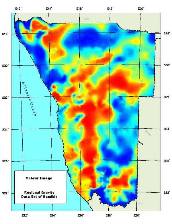